Total distance: 285.5 miles over 16 days
Our accommodation list:
Edale: Rambler Inn
Crowden: Peels Arms
Standedge: Carriage House
Hebden Bridge: Hare and Hounds
Haworth: Old Silent Inn
Malham: Buck Inn
Horton in Ribblesdale: Crown Hotel
Hawes: Bulls Head Hotel
Keld: Keld Lodge
Middleton in Teesdale: Teesdale Hotel
Langdon Beck: Landon Beck Hotel
Dufton: New Inn
Alston: The Cumberland Hotel
Greenhead: Samson Inn
Bellingham: Cheviot Hotel
Byrness: Forest View Inn
Kirk Yetholm: The Border Hotel

Showing posts with label Pennine Way. Show all posts
Showing posts with label Pennine Way. Show all posts
Sunday, 8 June 2014

Saturday, 7 June 2014
Pennine Way Day Sixteen - Byrness to Kirk Yetholm
Distance: 28 miles
Ascent: 1440m
Weather: sunny and warm
We were up at 5 and away about quarter to 6. We went back along the track that runs parallel to the road, munching pastries. Just before we headed uphill, we had a brief stop for Rob to put some padding on his bruised ankle. The birds were singing loudly and the midges were out in force.
A very wet muddy, slippy path up leads straight up the hillside through forestry. It was quite hard work and a bit of a shock to the system first thing in the morning.
Byrness Hill is the start of a grassy ridge that runs along the border between England and Scotland. Along the way, we discussed bog avoidance tactics, as there is a 'horrible' bog at Houx Hill which had been much mentioned by various people we'd met along the Way - often in sentences including 'up to my knees' and 'mountain rescue helicopter.' We'd seen on a website that improvements were to be made there and were hopeful that they might have begun. We needn't have worried, we got there to find a beautiful paved path weaving it's way through the mire.
Away from Houx Hill the ground becomes drier, and there are wooden duck boards over Ogre Hill. The ogre appears to have ripped up all the trees and left them in big piles of sawdust.
Through the tree stumps, a posse of angry small birds was chasing off a cuckoo. We passed a lichen covered signpost; eventually managing to decifer the words The Heart's Toe. Sadly too far off route to go and investigate what that could be.
The path goes around a Roman fort and medieval village (remains of) which looks big and impressive on the map but is just grassy lumps. There are strange signs around saying archaeological sites with symbols for no digging, no vehicles and no flame throwers.
A sharp corner is turned up Dere Street, a Roman Road, which we followed a while before turning off over a bridge and contouring around Wedder Hill, where we saw some feral goats with lots of little bleaty kids.
We are quite close to another military range here, and heard the sounds of guns but didn't see any of the promised pyrotechnics.
We veered off the right path slightly and came down a Goat trod to get back on track. It was about 10 o'clock and getting warm. The weather was forecast to be good today so we'd brought extra water with us.
Stopped at hut, more running repairs on Rob's ankle and I put my spare inner sole into my left shoe to cushion it a bit.
We met up with another Pennine Wayfarer, who walked with us for a few miles. Most of the afternoon, we followed a line of stone flags over moorland.
I startled a grouse and her chicks, they all rose up out of the ground and scattered in all directions, the mother squawking and not knowing which way to run.
The path took us over Lamb Hill, Beefstand Hill, Mozie Law. At Windy Gyle the trig point raised up strangely on a pile of rubble. Not sure why, maybe they measured it wrong.
More stone flags down and across moors, following the fence border, and a steep peaty slope up (stopping for a snack at a rock near the top) from King's Seat to junction above Hanging Stone where we decided to make the excursion to The Cheviot, which is more stone flags with one peaty, very muddy step. A quick photo and back.
On the way back, there was a phone incident and I had to go back 50 yards to look for it.
Getting back to the Pennine Way, we crossed the rocky top of Auchope Cairn and had a very steep descent down to a hut, using our walking poles for the first time on the walk. Then back up to 600m to the top of The Schil, via bogs.
Down gentler descent to Corbie Crag on Black Hag, crossed fence that was a bit worse for wear (at the last difficult muddy bit) and down a gently winding grassy track into the valley.
Saw hares, bunnies and a big deer fence.
The last mile or so is down a mercifully smooth lane down into Kirk Yetholm with one (seemingly) last steep bit of road up and down, just when you have started thinking you've finished, and we came to the green in Kirk Yetholm outside The Border Hotel and the end of the Pennine Way.


Thursday, 5 June 2014
Pennine Way Day Fifteen: Bellingham to Byrness
Distance: 16 miles
Ascent: 500m
Weather: damp start, mostly dry, heavy rain shower late on
Ascent: 500m
Weather: damp start, mostly dry, heavy rain shower late on
Rooks, Partridges, Skylarks, pippets, yellow green birds (possibly siskins)
Deer: 1
Bunnies: none!
Deer: 1
Bunnies: none!
The Pennine Way heads out of Bellingham on a road and then follows a track up to and through a farm, before leaving the tarmac and crossing the grassy fields. It was humid and cloudy and the route took a pleasant path (bit wet underfoot but firm) through heather over to Whiteley Pike where we stopped for first lunch and a sit down.The route to the lane at Gunstone is described as stone slabs slowly sinking into the bog. The slabs have been relaid since, but it looks like some are heading towards the same fate.
The path over Padon Hill (south and north) was quite rocky and a bit slippy, dropping down to a fence and some properly submerged slabs. Gorless Crag was muddy, wet and steep. At the top we headed around Rumblingsike Bog, following the boundary stones, where it was muddy, wet and flat.
There was a section of very wet forest, before we emerged on to a wide track that goes straight through Redesdale Forest. There were beautiful views over the forest, with patches of blue sky and atmospheric dark clouds. Eventually the atmosphere began to fall, so we put our waterproofs on, narrowly avoiding being mown down by a huge forestry truck.
A muddy path lead around to the River Rede and into Byrness. We are at the Forest View Inn, where the service has been excellent and we've even had our socks washed for us. Brave man.


Wednesday, 4 June 2014
Pennine Way Day Fourteen - Gilsland to Bellingham
Distance: 24 miles
Ascent: 1150m
Weather: Rain
Dipper, swans, housemartin flying in and out of nest
Wild strawberry, Orchids
Moments of bog related anxiety: 3
Bunnies: 2
Path uncertainty: a bit
We rejoined the Vallum this morning, it was liberally coated in sheep poo, and followed the Hadrian's Wall national trail for the morning. It took a bit longer than I was expecting, because it is considerably harder going than I expected. There are a lot of ups and downs, quite steep in places. The sight of the wall leading over the crags in the clouds into the distance was very impressive.
We briefly stopped at Walltown, which was an old quarry - where they dug out the dolerite to make roads again, this time taking part of the wall as well. This went on until the 1940s when someone noticed and put a stop to it.
The Pennine Way has been moved up to join the Hadrian's Wall path, it used to run along what is now marked on the map as The Roman Military Way. That is lower, and has less ascent, but no doubt is boggy.
We turned off north at Turret 37A and were immediately welcomed back to the Pennine Way with a muddy hillside down into a cow field with some ankle deep 'bog' water to wade through. And thus it began.
We alternated between moors (Bog) and forestry tracks (wet) and eventually made it to a road. Not necessarily the right road, but it was solid so we walked along it. The Way caught up with us very soon, and we crossed some farmland, with some slightly upset cows, down to a little stream that was quite a torrent, and had to jump over it. It was wide but manageable.
The last few fields into Bellingham were wet but the path was quite clear, right up until we realised that the signposts on the ground are different from the map, so we followed the old route into town.
We are staying at The Cheviot Hotel, which has fine porter and fine burgers and hopefully the roof won't leak on our heads during the night.


Tuesday, 3 June 2014
Pennine Way Day Thirteen - Alston to Gilsland
Due to a technical problem with the Blogger App, the entire post that I'd written for today is stuck in publishing limbo and it doesn't appear to be possible (even for the Sheep Trods' Head of Technical Stuff) to recover it. So with the aid of maps and photos, here's what we remember.
Distance: 19 miles
Ascent: 600m
Weather: fair
The Pennine Way is joined by Isaac's Tea Trail out of Alston, northwards out of town and up on to the moors. Isaac Hardy was apparently an 'itinerant' tea trader and notable Victorian who came from these parts - whether he liked walking or not I am not sure but he now has a trail named after him.
Along the valley by the South Tyne River there is another footpath, the South Tyne Trail, which many people use instead as it goes along a disused railway line (now opened again for tourist steam trains, although we didn't see any engines running today) along the valley floor rather than wiggling around over the moors to end up at the same place. Over breakfast this was suggested to us as a good option "unless you are purists." We appear to besticklers purists. We got to see Whitley Castle, a Roman Fort, which has extensive ditches and fortifications, cows and sheep.
Throughout the morning we saw a lot of other walkers, almost all of them from afar, on other paths or lanes, studiously avoiding the Pennine Way. Across one field, where the fingerpost clearly pointed the way diagonally across the field the grass meadow had clearly not been walked through in weeks and one of the stone step stiles had a big cobweb across it. At Merry Knowe you get to go through the backyards of a row of stone cottages, climbing over stone walls between each one, which was quite amusing.
A short detour at lunchtime took us to The Kirkstyle Inn where we had baguettes,chips and a pint each - which may not have been a good idea as I felt a bit bleary for the rest of the afternoon.
A straight path follows the Maiden Way Roman Road (course of) by a wall, and the going was good, mostly along a nice grassy path and into pretty valleys. Leaving the Roman road, we headed into Hartleyburn Common, where the Way leads between Round Hill and Cross Rig. We were following a nice track which lead us straight into the middle of a bog. Four wet feet later, we made it to higher, firmer ground on Blenkinsopp Common.
The Pennine Way leads to Greenhead to meet the Hadrian's Wall footpath, which is also a national trail. It is very popular so we'd booked accommodation in Gilsland, 1 mile west at Mile Castle 48. We left the PW at the Vallum (big ditch) at Haltwhistle Golf Club and followed a public footpath down to meet Hadrian's Wall. The footpath lead through a cow field and through a farm yard, muddying our shoes nicely just before we got to the pub. We stayed at the Samson Inn, named after the train - it is right next to the railway line. There are a lively mix of tourists, history buffs and dart players.


Distance: 19 miles
Ascent: 600m
Weather: fair
The Pennine Way is joined by Isaac's Tea Trail out of Alston, northwards out of town and up on to the moors. Isaac Hardy was apparently an 'itinerant' tea trader and notable Victorian who came from these parts - whether he liked walking or not I am not sure but he now has a trail named after him.
Along the valley by the South Tyne River there is another footpath, the South Tyne Trail, which many people use instead as it goes along a disused railway line (now opened again for tourist steam trains, although we didn't see any engines running today) along the valley floor rather than wiggling around over the moors to end up at the same place. Over breakfast this was suggested to us as a good option "unless you are purists." We appear to be
Throughout the morning we saw a lot of other walkers, almost all of them from afar, on other paths or lanes, studiously avoiding the Pennine Way. Across one field, where the fingerpost clearly pointed the way diagonally across the field the grass meadow had clearly not been walked through in weeks and one of the stone step stiles had a big cobweb across it. At Merry Knowe you get to go through the backyards of a row of stone cottages, climbing over stone walls between each one, which was quite amusing.
A short detour at lunchtime took us to The Kirkstyle Inn where we had baguettes,chips and a pint each - which may not have been a good idea as I felt a bit bleary for the rest of the afternoon.
A straight path follows the Maiden Way Roman Road (course of) by a wall, and the going was good, mostly along a nice grassy path and into pretty valleys. Leaving the Roman road, we headed into Hartleyburn Common, where the Way leads between Round Hill and Cross Rig. We were following a nice track which lead us straight into the middle of a bog. Four wet feet later, we made it to higher, firmer ground on Blenkinsopp Common.
The Pennine Way leads to Greenhead to meet the Hadrian's Wall footpath, which is also a national trail. It is very popular so we'd booked accommodation in Gilsland, 1 mile west at Mile Castle 48. We left the PW at the Vallum (big ditch) at Haltwhistle Golf Club and followed a public footpath down to meet Hadrian's Wall. The footpath lead through a cow field and through a farm yard, muddying our shoes nicely just before we got to the pub. We stayed at the Samson Inn, named after the train - it is right next to the railway line. There are a lively mix of tourists, history buffs and dart players.


Monday, 2 June 2014
Pennine Way Day Twelve - Dufton to Alston
Distance: 21.5 miles
Ascent: 1140m
Weather: cloudy
Humming snipe, golden plovers, curlews, hebridian sheep, geese in the mist, goats, millions of bunnies and chickens.
Ascent: 1140m
Weather: cloudy
Humming snipe, golden plovers, curlews, hebridian sheep, geese in the mist, goats, millions of bunnies and chickens.
As we were leaving the New Inn, they were getting ready for a busy day preparing for the Appleby Horse Fair - by moving the furniture and taking all the pictures off the walls.
The way back to Dufton didn't seem so far this morning, as we knew what to expect and how to avoid the swampy lake obstruction. In Dufton, there was a disparity between our map route and the guide book, so we it may be that we took a short cut, but it wasn't deliberate.
A wood lined footpath headed up on the moors, becoming a track through sheep fields. There were a couple of young sheep headbutting and scampering, who turned to look at us all innocence as we passed.
The Pennine Way turns off the track just through a gate with a stream and becomes a rocky path in the grass. A steep climb took us up to Green Fell, Knock Hush and into the clouds. The streams up here are called Hushes, from when there was mining for lead in the area. Dunfell Hush is marked as disused, so does that mean that the others are still in use? There are a lot of old mine workings and shafts. And Shake Holes. So many Shake Holes.
We passed the Knock Old Man cairn and walked over The Heights, Great Dunn Fell (which apparently has a big white radar dome on the top, we just saw the bottom of a couple of masts and some funny looking blobby things.)
A stone flagged path leads down towards Little Dunn Fell (where I thought we were at Cross Fell but we weren't) and then over some streams and up on to Cross Fell. There was bad visibility and we followed the map and a line of cairns to the shelter.
We had lunch at the shelter (with good company) and then followed the map and line of cairns off the summit.
The clouds began to clear as we descended, and apart from a few rain showers, it was dry most of the day. There were some impressive Cumulonimbus clouds and little patches of blue sky. A clear track lead down into Garrigill (where the shop and pub are shut down but they do have nice public loos) and then we walked alongside the South Tyne River (which you get to through a very strange scrap yard / chicken farm / rabbit sanctuary place) and though meadow fields until we got to Alston. You can tell you are getting near town by the amount of dog poo on the paths.
We are at the Cumberland Hotel in Alstom, which is nice. I have had a Bewcastle Brown Ale and Rob is having Yates. We have seen some horse and traps go by and there are quite a few horses in the field at the back. Again it seems that we've been lucky with the weather, as there are some cyclists here who've come from Penrith and it rained most of the way.


Sunday, 1 June 2014
Pennine Way Day Eleven - Langdon Beck to Brampton
Distance: 15 miles
Ascent: 375m
Weather: warm and sunny
Kestrel, buzzard, wheatear
Discarded stuff: lettuce, one trainer on Rasp Hill
Mole gibbets
Red flag warning of danger sheep
Frog, horses, mice
Hat incidents: 1
Retracing our steps back to Saur Hill Bridge, we met a couple with bird spotting scopes and asked them if they recognised a bird that we'd seen yesterday and couldn't place. It turned out to be a young blackbird, which are strangely big, speckled brown birds with black beaks.
Along Widdy Bank we were joined by a lady who didn't want to walk through the herd of cows by herself. There was a big bull in the field but it and the cows were all very placid. The baby ones were cute and curly haired.
Around the bank, the slopes get more scree and boulder, and under Falcon Clints there was a bit of clambering to get over some. Duck boards had been put in in places, and some stone slabs but many of them were submerged. Appropriately, we saw a kestrel hovering above.
Around a corner you are confronted by the dramatic Cauldron Snout waterfall and a short scramble up the rocks to get to the track and bridge at the top.
The path stays high passed a farm at Birkdale, and then follows a newly laid stone track up on to Rasp Hill, where there was a red flag flying warning of Danger Sheep. Or more likely, the MOD firing range on the other side of the fell.
We stopped for lunch in the sunshine on some rocks near Dobson Mere Foot.
There is a fancy new bridge crossing the river here, previously one had to ford the river or, if the water was too high, take a long detour around the top of the valley to another bridge. We thought that today fording wouldn't have been difficult, but seeing as someone had gone to the trouble of building a bridge, it would be churlish not to use it.
A quick sock faff and we made good progress over the grassy High Cup Plain towards High Cup Nick, where we stood and stared for a minute.
We then had a bit of a reunion other Pennine Way Walkers who have met before on previous walks. Small world indeed.
There were vertigo inducing cliffs down into the Nick, and very worrying sheep running about on them. Once the path had moved onto gentler ground, we stopped for a short break on Peeping Hill to admire the views over to the Lake District.
A pretty track leads down into Dufton, and then we took a Green Lane to Brampton and The New Inn. The green lane started well but there was a lake that took some negotiating and a lot of muddy puddles.


Pennine Way Day Ten - Middleton to Langdon Beck
Distance: 10.5 miles
Ascent: 220m
Weather: fine, sunny spells
Unidentified brown mammals: 2
Unidentified brown birds: 1
Identified brown feet: 1
Rabbits: thousands of them
Lapwings, pheasant, buzzard, dipper, friendly great tit, thrush, snipe (making a chuff-chuff noise, not the flappy noise)
Violets, forget-me-not, comfrey, campion, buttercups, bluebells - all very pretty but not sure they're quite the rare arctic alpine flowers promised on the notice boards.
Alarm issues notwithstanding, we were away just before ten, and rejoined the Pennine Way just over the bridge near the cattle market in Middleton and followed the track which became a pretty path through flower meadows and fields.
We saw lots of bunnies, pheasant and a mouse, plus something without a head that could have once been a shrew.
The path enters some woods and then meets the River Tees, which is wide and rocky. The valley is very impressive and quite different from the dales and moors of the previous days.
We detoured off to Bowlees over the Wynch Bridge (a chainlink bridge that you have to cross one at a time) and its visitor centre to meet Pam and Martyn and the girls, who brought a picnic and joined us for the walk up from Low Force passed High Force and up to the top of Bracken Rigg. Well, almost all of us made it to the top of the hill, there was a muddy stream incident that resulted in one rather brown shoe which put someone off going any further.
After the others turned back, we carried on along the grassy ridge with juniper bushes and many rabbit holes, to drop down behind a farm at Cronkley, and then walked beside the river up the valley towards Langdon Beck, trying to identify some of the birds and flowers along the way without much success.
We are staying at The Langdon Beck Hotel, which is surprisingly heaving for somewhere in the middle of nowhere.


Friday, 30 May 2014
Pennine Way Day Nine - Keld to Middleton in Teesdale
Distance: 21.5 miles
Ascent: 850m
Weather: overcast, light breeze
Lapwings, curlews, plovers, strange humming flappy birds, weasel, more bunnies than you can shake a stick at, voles, Americans. Sheep surprised by a bird, stampeded bunny.
Discarded footwear update: one white Nike.
Anyone who has read any of this blog before will know that we like a bog. Everyone loves a bog. However, today was taking things to the extreme.
Just assume, unless otherwise stated, that we are in a bog.
Leaving Keld, we stopped for a look at the Catrake Force waterfall and then headed up the track (heard an odd bird sound, a bit like the percussion instruments you play at primary school) around Black Moor onto Stonesdale Moor towards Tan Hill. We called in at the Tan Hill Inn for a coffee (not a bog) and then set off, to the quacking of ducks, down to Sleightholme Moor. The way was not clear for a while to start with, but became more obvious the further along Frumming Beck we got. Just passed Washfold Rigg we joined a track (not bog) which went down to Sleightholme Farm where we left it, at The Bog, next to Bog Scar, and over to God's Bridge where we had lunch on the massive limestone rock (not a bog) that crosses the River Greta.
Under the A66 there is an underpass (not a bog) and beside it there is a lot of rubbish.
We went north over to Ravock Castle, Knott Hills, Race Yate, passing what are marked on the map as Bields. We looked Bield up, and it means a shelter. There is a shelter at the footbridge at Peatbrigg Hill but that isn't marked on the map.
It is beautiful and not a bog around Hannah's Meadow, which is a nature reserve at the farm where Hannah Hauxwell used to live. We saw a weasel. It was obliging enough to let me take a photo.
We had a sit down at a picnic spot near Grassholme Reservoir and then crossed the fields, which became drier and grassy - nice to walk on at the end of a long day - over Wythes Hill and down into Middleton in Teesdale. We met some playful cows, saw a gazillion bunnies (one that looked surprised to find itself being chased by herd of playful cows) and figured out that the noise we'd heard first thing, and were now hearing again into the evening, was coming from a bird in flight. It turned out to be a snipe, the noise is made when it vibrated it's wings in descent.
We also heard what I thought might have been a toad, but now we think was probably a woodcock.
We are staying at The Teesdale Hotel and have washed an enormous amount of mud out of my trousers and eaten an enormous amount of food.


Thursday, 29 May 2014
Pennine Way Day Eight - Hawes to Keld
Distance: 13.5 miles
Ascent: 750m
Weather: cloudy, bit wet above 600m
Highest flower: intrepid poppy at 710m
The first point of interest of the day was a visit to Hawdraw waterfall. Unsurprisingly, given the amount of rain there's been lately, water it was very impressive - much more so than when we visited in 2011 on our North of England Way walk when there was just a dribble.
We then set off proper, on the track up Bluebell Hill up the side of Wensleydale. The path heads up a wide ridge, over Hearn Top, Black Hill Moss and up to Great Shunner Fell, getting wetter and windier the higher we got into the clag and then better again as we dropped down the other side into the next valley. On Black Hill Moss we saw some fine examples of bogs and deer grass, and also fossilised trees which look like tyre tracks. We thought that the fossils would be tricky to spot, as there were quite a few actual tyre tracks on the route lower on the hill, but they were quite easily distinguishable.
We had lunch at the shelter on Great Shunner Fell and the clouds began to lift, soon there were views into Swaledale, over Thwaite and Mucker.
In Thwaite we called in at a coffee shop for cream teas (first of our holiday!) where Rob had a play with a boot cover dispenser and I just took my shoes off and left them by the door.
Just north of Thwaite is a place on the map called Dirty Piece. We didn't go there.
The Pennine Way goes out of the village up a little path - which Rob commented had something wrong with it, but normality resumed soon enough when water began gushing down it - that leads around into Swaledale. The grassy path levels out and gives spectacular views over the dale, which is stunningly beautiful. We met pheasants, swaledale sheep and lambs, bunnies (in a bunny castle) and saw masses of primroses, bluebells, saxifrage, forget-me-not, and other flowers.
We turned off the Way into Keld by some waterfalls and walked through the village, which is very pretty and even has an old fashioned red telephone box, that apparently works.
We are staying at The Keld Lodge and have been very well fed indeed. We also bumped into the same German chap whom we met on Offa's Dyke two years ago. Small world.


Wednesday, 28 May 2014
Pennine Way Day Seven - Horton to Hawes
Distance: 13.5 miles
Ascent: 550m
Weather: wind and rain
Unidentified brown mammals: 1
Ascent: 550m
Weather: wind and rain
Unidentified brown mammals: 1
Yesterday's walk was quite zigzagged, and the end of the day was almost southbound. Today was pretty much a straight path north north west towards Hawes.
It rained and the wind blew. The paths were good on the whole, a bit muddy at times. Again we are in an area of pot holes and caves, with lots of Shake Holes and places with the word Hole in their name. We also visited Dismal Hill and Rottenstone Hill.
Half way through the day, the Pennine Way joins the Dales Way, along the High Cam Road, which is the highest Roman Road in England. There were fossils in the rocks shaped like nuts and bolts and some interesting geology, mostly involving holes in the ground.
We had a short lunch break and after something to eat, and getting wrapped up warmer (had fun getting into my KitKat with mittens on, in a gale) felt much better.
We came down across the fields into Hawes, where we are staying at The Bulls Head Hotel. We had dinner at Crockett's Restaurant which was very nice, with a bottle of wine, and were very sensible and went back to the room for a hot chocolate rather than going to the pub.


Tuesday, 27 May 2014
Pennine Way Day Six - Malham to Horton in Ribblesdale
Distance: 14.5 miles
Ascent: 850m
Weather: sunny, breezy
Ascent: 850m
Weather: sunny, breezy
Green Woodpeckers: 2
Heard peregrines and also some mysterious squeaking in the rocks
Bunnies, possibly a rat
Wheatear
Short eared owl.
Discarded footwear so far: one flip flop on Kinder Scout, one flip flop on Standedge, two insoles at the bottom of Pen-y-Ghent.
Heard peregrines and also some mysterious squeaking in the rocks
Bunnies, possibly a rat
Wheatear
Short eared owl.
Discarded footwear so far: one flip flop on Kinder Scout, one flip flop on Standedge, two insoles at the bottom of Pen-y-Ghent.
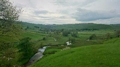
The Pennine Way out of Malham is a well used tourist path that leads to Malham Cove. The gates tell of a peregrine viewing point, but the stone steps lead steeply up around the cove before we got to it. As we neared the top of the steps we could hear them and thought that we might have seen one, or possibly a budgie, but it turned out to be a woodpecker.
The limestone pavement across the top of the escarpment is very impressive, and quite slippy, the stones of one of the stiles were polished till they shone.
The limestone pavement across the top of the escarpment is very impressive, and quite slippy, the stones of one of the stiles were polished till they shone.
We walked over the stone edge a while and then the Way leads around the back of the cove, north along Ing Scar. There was a nipply hill, many earthworks, lots of things written in italics on the map. In amongst the areas of shake holes and pot holes. It's very holey round here.
From the gully, the land opens up into grassy uplands with slippy limestone rocks. We crossed a narrow lane and walked around the grassy banks of Malham Tarn, and in the woods on the far side we saw a short eared owl sitting in a tree. A chap from the outdoors centre had heard reports of an owl and was out looking for it. Apparently it had been seen further away and must have moved. We never touched it. Honest.
The way turns off the lane through a gate (adorned with skull - nice) where we passed a group of chaps taking a break, and along a grassy path over the hill up to Fountains Fell. Some old farm buildings with lots of flies and swallows. We stopped for first lunch by some rocks about half way up the hill. I saw something that might have been a rat.
At the top of Fountains Fell there are lots of mine shafts, and lots of holes everywhere. Some of them had sheep in them, one had a blonde lady. We crossed a wall and came down to a lane and walked along that for a while, with fine views of Ingleborough and Pen-y-Ghent ahead. We had second lunch on some rocks near the cattle grid, and were passed by the group of walkers from earlier.
The path climbs up gently along a ridge and then rises steeply up Pen-y-Ghent, a bit of a scramble and then an easy path to the top. We passed the stragglers before the route had even got steep, and the others at the top.
A wide gravel path leads down, clear across the heather, then became a stony track through farms into Horton In Ribblesdale. We are staying at The Crown Hotel, and have seen lots of walkers in various states of knackedness / limping. Most people seem to be doing the Yorkshire Three Peaks.
A chap at the bar has been saying he'd ridden up from London today and it had rained all the way to Skipton, so we've been lucky.


Monday, 26 May 2014
Pennine Way Day Five - Haworth to Malham
Distance: 23.5 miles
Ascent: 975m
Weather: warm and sunny
Things on Sheep: one bucket, two birds hitching a ride
Swimming cows: 1
Sit downs: just the one very short one
Ascent: 975m
Weather: warm and sunny
Things on Sheep: one bucket, two birds hitching a ride
Swimming cows: 1
Sit downs: just the one very short one
Cow pat / rock dualities: one (ew)
Feet: hot and a bit dirty (ew)
Herons, bunnies, peacock, little lambs, bullfinch, field fares, dive bombing lapwings, fly-by squawking curlews, gulls, oyster catchers, little goats, herded some geese, got herded along with some sheep.
Had a comfortable night's sleep at The Old Silent Inn, untroubled by ghosts. In the morning, we noticed a certificate on the wall which said the place is officially haunted, according to that The Paranormal Association of Britain or some such.
We were later than planned setting off, due to breakfast being late. Our very convivial host was no where to be seen anyway, and we were not convinced that his being busy with the farm was entirely the reason.
Ickornshaw Moor was boggy, but really pretty. The wonders of sunshine. Although you'd expect somewhere called The Sea to be a bit wet...
Walked through Ickornshaw village, where many of the stone house seemed to have fallen down and the people taken up residence in huts. The residents also seemed to be mostly geese, chickens and goats.
The country turned from south Pennine moorland to hilly farmland of the dales. More cow fields and country lanes. We had a brief sit on a bench and had some lunch, and met a couple of Dutch walkers having a sit down right in front of a gate who are also doing the Pennine Way, although they are doing it properly and camping. Poor buggers. Just after we left them, we went through a small muddy field with some cows, the cows were a bit frisky and seemed nervous about which way to go. Some went up the hillside to go crashing through the trees at the top of the field, but one seemed a bit indecisive and hung around at the back of the group, until it panicked and rushed off through the reeds, and then had to practically swim to get out. There was a bit of mooing and much splashing, it made it out ok, thankfully.
We went a short distance along the Leeds and Liverpool canal, stopping to pay a small fortune for ice creams and some more water.
The last part of the day, about 7 miles after Gargrave was along a pretty riverbank. We saw lots of curlews and ducks. The landscape becomes noticeably rockier and then we were into Malham. They are having a strange safari event at the moment, including a huge model of giraffes in horse drawn carts.
We are staying at The Buck Inn, which has good beer and fine Yorkshire puddings.


Sunday, 25 May 2014
Pennine Way Day Four - Hebden Bridge to Haworth
Distance: 13 miles
Ascent: 600m
Weather: dry and sunny start and finish, but mostly wet.
Ascent: 600m
Weather: dry and sunny start and finish, but mostly wet.
So today we were out on the wild and windy moors, but thankfully there was no rolling or falling in green. And no Kate Bush impressions either, as there was to be none of that, apparently.
Getting down to Hebden Bridge and back along the canal (saw a Muscovy Duck) seemed a lot easier this morning with gravity on our side.
We then crossed the road and headed up the other side of the valley, up a very steep little cobbled path. There are paths in all directions here and we had to make a choice between the official route and the Wainwright route. We went with the official. A muddy, overgrown little path takes you by an odd water spout thing, then to a tree lined lane and then up on to farm land and fields.
The path crosses a pretty dell with bluebells signposted Hebble Hole (although that doesn't seem to be marked on the map) with a stone footbridge that looks very old and worn indeed, and is even a listed building.
Out on the tops there were lots of curlews and lapwings chirping, especially when we stopped for lunch on a wall, watching the black clouds and impending rain approach over the hills. A hasty pack up was called for and we walked in the rain for a long time after.
The Way goes down a wide tarmac lane with signs forbidding mountain biking, around a couple of reservoirs, one of which was nearly completely empty despite the weather, then up Dean Stones Edge over the rolling moorland (between Round Hill and Dick Delf Hill) to Top Withins. There were quite a few visitors to the ruins out in the rain.
The sun came out as we approached Ponden Reservoir, where we turned off down a lane to get to The Old Silent Inn.


Saturday, 24 May 2014
Pennine Way Day Three - Standedge to Hebden Bridge
Distance: 18 miles
Ascent: 600m
Weather: misty, then rain, wind and rain, blue sky and sunshine (a bit)
It was misty but dry as we started this morning, over the A62 and over Standedge Edge. There was a family with a couple of very energetic little boys running around arms flapping. Dad had a huge flask.
A hat change was called for, it was pretty windy. The rain started as we got to the trig point on White Hill and continued to get heavier during the day. The paths near here are very familiar to us and we'd thought that it would be strange to do a long distance path so close to home. Mostly it was just wet. The renovation of the path up to Blackstone Edge has been done and it is now very different, seems like a completely different footpath.
We passed the Aigen Stone and walked down the little path across the heather (which is the Pennine Way but most people seem to go the other way down the Roman Road) down to the White House Inn (coming upon a horde of walkers who seemed to emerge from a hole in the ground) and took shelter from the weather inside with a big pot of tea and some lunch.
After lunch, the rain was noticeably harder and the wind noticeably stronger. It was fairly unpleasant walking passed the reservoirs on the straight track. The track becomes smaller and then crosses the boggy ground as a stone flagged path, which gurgled and tipped occasionally.
The guide book mentions Stoodley Pike being visible but never seeming to get any closer, we didn't really have that problem today, as the mist was so low we couldn't see it until we were quite close. The rain stopped and the clouds began to clear, and a stone seat conveniently appeared so we stopped for a sit down and some tea and biscuits.
We didn't go up Stoodley Pike as it was pitch dark inside and not straight, according to Rob. It has already fallen down once before so you can't be too careful (although that was in 1850-something.)
The skies were clearing as we came down off the moors, and it was much warmer. We are staying in Hebden Bridge, so left the Pennine Way and walked along the canal to town. There were lots of ducklings and goslings and we got hissed at quite a lot.
Hebden Bridge is very, very hilly. We chose to stay at the Hare and Hounds in one of the villages just (just!) up out of town.
Ed. I can't believe that I forgot to mention this, but the weirdest thing we saw today (and possibly ever) was a group of chaps coming down off the moors as we left the White House Inn wearing not much but white robes (possibly bedsheets) in a torrential rain storm. Not sure if it was for a religious thing or for a bet....


Friday, 23 May 2014
Pennine Way Day Two - Padfield to Standedge
Distance: 17 miles
Ascent: 950m
Weather: wet, wet, less wet, wet
Bogs, rivers, ponds, rain, mist
Ascent: 950m
Weather: wet, wet, less wet, wet
Bogs, rivers, ponds, rain, mist
Buzzards, red kites, baby pheasants.
Forgotten keys: 1
Detours: 1
As we set off this morning, there was blue sky and a very bright rainbow, unfortunately just not in the direction that we were going in. The skies over the hills were very dark and wet looking indeed. We retraced our steps back to the end of the Trans Pennine Trail and, taking a brief look down a slippy tunnel, went a bit further and over the reservoir. There was a nice little wood to act as a wind break, but at Crowden we turned up the valley into the wind and rain. There were some birds of prey, definitely some of them were buzzards, some might have been red kites. As we headed up the valley side towards Laddow Rocks, we met a runner coming the other way who commented that there were a couple of gnarly river crossings ahead. He wasn't wrong.
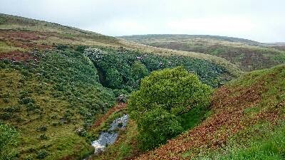
Everything was in spate. The paths were streams, the streams were rivers and the fords were indistinguishable from them. We managed to avoid the gnarliest of the river crossings by heading up the hillside, and took a few detours upstream to find crossing places over others, the one near North Grain took a while, with much wandering through wet grassy bogginess. But we made it over the stream (me by flinging myself head first into the reeds on the other side) and back to the stone flagged path, which was much appreciated even if it was running with water.
Coming down off Black Hill we saw a sign cautioning about the difficult ford crossing at Dean Clough so decided it would be wise to take note. The detour added an extra mile, through wet grass, fords and more bog (Rob was lucky to escape with his shoe from one - we decided that the crossing at Dean Clough must have been very difficult indeed, possibly even guarded by bears) on to the Intake road and returned via the Kirklees Way, having to climb over a chained up gate which was odd.
No sign of the burger van as we crossed the Isle of Skye road, then headed down to Wessenden Reservoir, startling a pheasant with some babies. It was dry-ish but misty along here.
As we dropped down and back up the steep clough, the heavens opened, but soon it was blue sky and sunshine, and lots of birds singing. It rained again as we got near the reservoir and the A62, but as we went in the pub it stopped. We are staying at The Carriage House, which is very comfortable and does lovely Turkish food.

Thursday, 22 May 2014
Pennine Way Day One - Edale to Padfield
Distance: 17 miles
Ascent: 800m
Weather: rain first thing, then cloudy, cool
Mountain hares: lots
Red grouse, golden plovers, Buzzard (Rob saw this, I was watching where I was putting my feet at the time), bunny, four bees.
Ascent: 800m
Weather: rain first thing, then cloudy, cool
Mountain hares: lots
Red grouse, golden plovers, Buzzard (Rob saw this, I was watching where I was putting my feet at the time), bunny, four bees.
As we left Edale in the rain, we heard a murder of crows and then saw a dead blackbird. Hopefully these are not portentous.
The path led through sheep fields with lots of lambs and along the valley from Upper Booth and then up Jacob's Ladder. This was quite steep but not bad. Over Kinder Low and Kinder Downfall we saw no one (but a startled rabbit) and were starting to think this was a bit strange, when we came upon various hordes.
The rain stopped but it was still quite chill, gloves were put on and taken off a lot.
We stopped for lunch in a sheltered spot and the sun came out briefly. Very glad that we'd brought the flask.
The stone flagged path was quite easy going, but the rocky paths are quite hard work. Bleaklow wasn't bleak at all but very green where it has been reseeded, and there were lots of birds and hares. Most of them were alive.
The path to Crowden went up a steep sided valley with more up than I expected, and then down a very steep little path to the Trans Pennine Trail where we turned off down to Padfield (being chased by dark clouds and impending rain) to the Peels Arms.


Subscribe to:
Posts (Atom)