Distance: 77.4 miles over 4 days
Accommodation:
The Queens Arms, Old Glossop
Dog and Partridge, Langsett
YHA Edale
The Bulls Head, Old Glossop

Wednesday, 30 March 2016
Monday, 28 March 2016
Kinder Loop* Day Four - Glossop to Oldham
*Technically not the Kinder Loop
Distance: 18 miles
Ascent: 690m
Weather: overcast, showers
Mud: very
Socks: wet
Ducks: happy
After a pleasant night at the Bulls Head in Old Glossop, it was quite dry although cloudy when we set off at about nine thirty. There was snow on the tops and the news on the local radio had talked about flooding and heavy rain after Storm Katie last night.
At about 11am we had just about made it out of town, after 4 miles walking through Glossop, Dinting Vale and Hollingworth. The Pennine Bridleway Walkers Interim route, which we've been following vaguely when it was somewhat randomly signed, led us out of a housing estate and straight into a cow field.
The path was a muddy and slow going, through cow-y fields and through a nature reserve, then through more grassy fields and a wet grassy lane, following the Tameside Trail. The path became rockier, then crossed between Higher and Lower Swineshaw Reservoirs, where we took the higher route over Slatepit Moor. It was raining quite hard here.
We descended into Carbrook, then walked above Mossley on Moor Edge Road, where there was a distinct onion flavour, and down into the valley using the Oldham Way / Pennine Bridleway path. We had lunch on a bench overlooking a farm yardy campsite, then set off quickly as the rain restarted.
Passing the sewage treatment works, we joined the canal at Greenfield to Dobcross, then the Donkey Line to Delph. It rained quite hard here too.
As we came over Hill Top Lane and down Ripponden Road, the rain stopped and it was quite sunny.


Sunday, 27 March 2016
Kinder Loop Day Three - Edale to Glossop
Distance: 20.3m
Ascent: 1100m
Weather: lots, some of it is in our shoes
Ascent: 1100m
Weather: lots, some of it is in our shoes
Fox, heron, great crested grebe, crappy dog owners
Breakfast was at 7:30am and we were set off by 9am. A bit of wiggly road walking took us to a bridleway lane passing a campsite with limited facilities, and up to Mam Tor. It was quite sunny and a bit windy up on the ridge, but not as blowy as yesterday, we followed the ring of hills around Rushup Edge to South Head. We didn't go up South Head because it hailed. Approaching Hayfield, we walked through sheep fields above Coldwell Clough, where a couple definitely didn't have their dog under control, and dog wasn't as well trained as they'd assumed.
A pretty walled path brought us down into Hayfield, where we called in at the visitor centre and then had lunch at a bench in Bluebell Wood, a few weeks premature for the bluebells.
Leaving Hayfield up a steep lane, another pretty path took us under Lantern Pike, with storm clouds gathering behind. A family had just started walking up to the top as we came through the gate, not sure what they did as the hail, thunder and lightning started, but we sat down by a wall, put our waterproofs on and waited it out. It hailed for a while, turning everything white, and after ten minutes it cleared to rain, the thunder moving over Kinder Scout, and we set off again down the Pennine Bridleway over the grassy ridge.
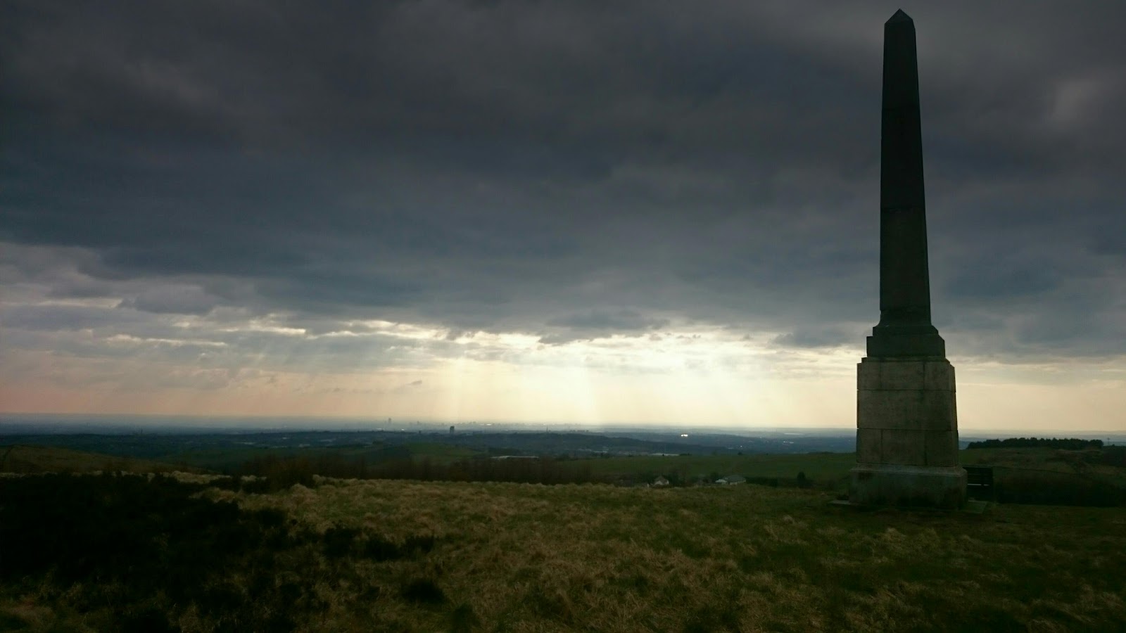
The route followed some lanes for a while, then got confusing, seemingly leading to roads and housing estates for the last few miles. We decided to make our own way a while, up a possibly closed section of the Pennine Bridleway then over footpaths in open access land, over Cown Edge, then through fields around Coombes Edge into Simmondsly, passing a fancy place with massive duck ponds, and through Glossop. The heavens opened, and we were properly wet through as we came to the Bulls Head in Old Glossop, where we've had fine beer and tapas.


Saturday, 26 March 2016
Kinder Loop Day Two - Langsett to Edale
Distance: 17.5 miles
Ascent: 900ish m
Weather: windy, varying degrees of clag, rain, hail
Curlews and lapwings
Bunnies: 3
Mountain hare: 1
Red grouse: lots
Grey wagtails: 2
Gripes: mountain bikers who don't ride on the actual path and people who litter orange peel and hard boiled egg shells.
Ascent: 900ish m
Weather: windy, varying degrees of clag, rain, hail
Curlews and lapwings
Bunnies: 3
Mountain hare: 1
Red grouse: lots
Grey wagtails: 2
Gripes: mountain bikers who don't ride on the actual path and people who litter orange peel and hard boiled egg shells.
Loaded up with food, we set off just before 10am, out into the wind. The rain wasn't forecast until later, but the clag was low and very damp. Rob was sensible and put his waterproofs on straight away, me not so much.
The grassy path was still pleasant and grassy, especially behind the walls that sheltered from the wind. Once out of the trees at Langsett woods, we climbed steadily up onto the open moorland on Hingcliff Common where it was very wet, very windy and very full of red grouse.
The rocky path along Mickleden Edge and Cut Gate became quite muddy and rutted on the plateau near to Margery Hill and there was a bit of scrabbling around in the heather. I got a wet toe.
We passed some intrepid mountain bikers heading up, as we were coming down Cranberry Clough to Slippery Stones (which were indeed slippy) to the top of Howden Reservoir, and then met more bikers at the main path around the reservoirs, who asked us if we had any information. The required information turned out to be a look at our map to see if the path went all the way around. It does.
We had lunch on a little grassy bit at the lakeshore, and contemplated how damp we were. Rob's mustard got a bit much for him at one point, but he survived manfully.
Below Howden Reservoir is Derwent, then Ladybower, where we called in at the visitor centre, then followed a bridleway up Haggside, passing Open Hagg and Haggtor Coppice.
Here we met a group of DOE'ers, who asked us if we knew how far it was to the campsite. No.
Crossing Jaggers Clough was a bit wet, but manageable, and at some point around here it started to rain. Then it got dark. Then it hailed. It was pretty miserable, with stinging hail and wind, not being able to see a thing and having very wet feet, the paths seemed to turn to streams almost instantly. Thankfully we made it to the YHA without mishap, and have got clean and dry and well fed.
The clocks go forward tonight, another reason for an early night.


Friday, 25 March 2016
Kinder Loop Day 1 - Glossop to Langsett
Distance: 21.6 miles
Ascent: 550m
Weather: sunny
Ascent: 550m
Weather: sunny
Animatronic robins
Woodpecker
Long tailed tits
Buzzards
Oyster catchers
Curlews
Lapwings
Frogs frogging
Mallard on a tiny pond
Red grouse
Pied wagtail
Kestrel
Thing on wall (ed. meadow pippet)
Hare
Pheasant
Bunnies: oodles
Woodpecker
Long tailed tits
Buzzards
Oyster catchers
Curlews
Lapwings
Frogs frogging
Mallard on a tiny pond
Red grouse
Pied wagtail
Kestrel
Thing on wall (ed. meadow pippet)
Hare
Pheasant
Bunnies: oodles
Well fed, we set off from the Queens Arms Inn in Old Glossop and walked through the park (where the small child falling over into the wall was not at all amusing) and into town.
We took a lane up to Mouselow Hill, where the motte is now a mobile phone mast. Possibly we could have taken a more direct path, but we got put off by a big sign in the distance saying private. At the other side, there was clearly a path through, so we should have gone to investigate more closely.
At Padfield we joined the Longenden Trail and then the Trans Pennine Trail (east) and followed this for the next few miles, above Rhodeswood, Torside and Woodhead Reservoirs. At the entrance to the old Woodhead tunnel, we crossed the road and headed up on to the moorland above. There were significantly fewer people up here, and significantly more sheep and birds.
At Dunsford Bridge it got busier again with walkers and cyclists, we stopped for lunch on one of the benches handily placed every km into Penistone, with buzzards circling overhead and curlews calling.
We left the TPT at Eckland and then followed bridleways towards Langsett Reservoir, where we left the Kinder Loop for the day. A very pleasant grassy path took us to the Dog and Partridge hotel, where we have a room with a view of lapwings and bunnies.


Sunday, 20 March 2016
Around Saddleworth
Distance: 12 miles
Ascent: 525m
Weather: dry and sunny, clouding up in afternoon
Butterflies 3
Discarded wellies: 1
Frogs: rude
It was quite warm and sunny when we set off this morning at about 11am. With feet well taped and padded, I wore my pink asics from last year's Downs Ways walk. On the whole feet were ok, but my little toes were still pretty painful.
We took a different route around Strinesdale and into Lees, calling in at the co-op there for lunch supplies - pretty much the same as yesterday but with rocky road instead of brownie and coke life rather than the cherry stuff which tasted weird.
We ate lunch in the park beyond the bear and then walked through Lydgate and Grasscroft and up to Wharmton Hill where we followed the path along the wall rather than going to the aerial at the top.
We stopped for tea and Snickers bars along the Donkey Trail and had a sit down. Returned via Delph up Ship Lane and over Bishop's Park and Besom Hill. We didn't call in for crisps, which was a mistake.

Saturday, 19 March 2016
Around Denshaw
Distance: 17 miles
Ascent: 870m
Weather: cold and cloudy
Kestrels, goosanders, mallards, great crested grebe, vole, bunnies, curlew and a short eared owl.
Sore feet: me
Ascent: 870m
Weather: cold and cloudy
Kestrels, goosanders, mallards, great crested grebe, vole, bunnies, curlew and a short eared owl.
Sore feet: me
We set off without any real route or plan other than that we needed to call in at the co-op for something for lunch.
I had shoe regret fairly early on, and by the end of the day was contemplating putting them straight in the bin when we got home. These are the black and silver asics, which I think are too big for me so my feet are moving around in them.
We went around Strinesdale and along Badger Edge Lane to Ship Lane, taking a grassy path to the left over the hillside and down the grassy sloped path into the village centre. We walked along the main street and up a track to Heights, seeing some exotic sheep (jacobs and something creamy brown with horns) and getting barked at by a little dog named Tidge.
Lunch was had (quite long time after we noted how hungry we were) along the Pennine Bridleway in the shelter of a wall and we had flask regret. But the roast pork and apple sauce sandwiches were nice.
Some coat and foot tape faffing and we set off around the reservoir and along to Piethorne, where we took the path through the trees on the far side and then crossed back at the wall. At the car park I put more tape on my feet and used the facilities. We took a grassy footpath up opposite the ranger's office which meets up with a nice bridleway track that comes out at the cattery. There are some really interesting looking old farm houses here.
At Brushes Clough we watched a short eared owl hunting low over the moorland, it was still quite light and the owl didn't seem bothered by us at all.
We took the path directly down to the lower car park, where someone had flytipped some bags of potatoes over a wall and then returned, somewhat slowly, along the track. We were accompanied part way by a lady out walking her inquisitive golden retriever.


Subscribe to:
Posts (Atom)