Showing posts with label North Downs Way. Show all posts

Saturday, 30 May 2015

North Downs Way - Day 9

Dover to Canterbury
Distance: 20.5 miles
Ascent: 450m
Weather: warm and sunny

Abandoned socks: 1
Foxes: 3
Bunnies galore
Yellowhammer, buzzards, kestrel, skylarks
Big chicken standing next to a very small horse

We left Dover in the sunshine, heading north. This side of town is a bit posher than the way we came yesterday evening passed the Immigration Removal Centre (shown on our older paper map as the Young Offenders Institution.)

Beyond the recreation ground (ladies doing their exercises) the NDW turns up a tree-lined byway which follows the course of a Roman road. It was closed to vehicles while awaiting repairs and was quite rutted in places.

At Guston the new route of the path takes a sharp right, up to a bridge that crosses a dual carriageway, and then back. There were lots of flies along here and then we had to cross a field, taking a fair bit of it away with us attached to the bottom of our shoes.

We stopped for a tea break on bench in an overgrown church yard and then walked through the lovely little Piddle Wood, which is a tiny, circular copse with gates either side. It's just the sort of place that could be a portal to another dimension, although everything seemed much the same on the other side, it was possibly a bit sunnier.

Through Waldershare Park there were big old trees in the parkland and then big old trees in the fields like little islands of trees and flowers, overlooked by an old tower.

A very straight line took us through crop fields and across Balham Downs, almost parallel to the dual carriageway, which uses the course of the Roman Road here.

We got to walk by the side of it for a while,  skirting aroung Higham park and gardens (shoddy front garden from what I could see) but an impressive orchard and surrounding parkland.

Around the other side of the house, we returned into park/farmland with a kestrel overhead. Near the last marker post (which says 15 miles to Dover when actually it's 18) and had a sit down and some tea and the last of the biscuits (apart from the pack of bourbons and melted, squashed mars bar we've been carrying around for the last ten days. Actually the mars bar is probably more like 16 days.)

Patrixbourne is a pretty village with thatched cottages and the church has a very intricately carved doorway.

We walked along lanes into Canterbury and made our way to the Cathedral. There are repairs underway on the 12th century round window and much scaffolding.

We are staying at The Cathedral Gate Hotel,  which is just that - on the gate overlooking the cathedral. It's a very old, warren-like building with alarmingly sloping floors.

Due to a mix up (which probably occurred as we came through Piddle Wood) it's turned out to be very good value. We ate out at La Trappiste around the corner, which was great, and we had a selection of their speciality (incredibly strong) Belgian beers.

Friday, 29 May 2015

North Downs Way - Day 8

Brabourne to Dover
Distance: 19 miles
Ascent: 1000m
Weather: very windy, rain in afternoon
Buzzard, bunnies, pheasant, crows, pill boxes, white horse.
Runners happened upon in shrubberies: 1
Huge rabbit holes: 4
Cows: very moo-y

The weather forecast for today was pretty bad. The lady on radio Kent FM kept going on about torrential rain and lightning. There'd been a lovely sunset last night, but the weather front coming in tomorrow afternoon promised to be interesting.

We had breakfast at the same table as a wedding party, who were even more obsessed with the weather forecast than we were.

The day started with blue sky and patchy clouds,  with strong winds which built as the day went on. A murder of crows was silhouetted against the tree line against the rather ominous dark clouds.

We crossed lots of styles, some of them wobbly, with many bunnies and pheasants around the field edges.

The rain started just about on schedule just as we reached Dover Hill. Thankfully the Valiant Sailor pub was just around the corner and open for lunch for people who are neither valiant nor sailors. We'd just sat down when the rain started lashing at the windows.

Nearly two hours later we decided we should make a move, donned our waterproofs and headed out. The wind had dropped, and the rain eased off a short while later, with blue skies clearing and large Cumulonimbus clouds over the Channel. 

The paths over the coastline (or sea line, as it's sometimes called by people who know about such things) were muddy, much of it sticking to our shoes.

Countless lives were lost during the course of the afternoon. The footpath over Shakespeare Cliff was carpeted in snails. Poor snails. So crunchy. 

The NDW enters Dover via the Western Heights and the Drop Redoubt, which has an impressive number of bricks.

We are staying at the Best Western hotel on the seafront in Dover and had dinner, with Whitstable Bay beer, looking out at the harbour, with ships coming and going, plus some people trying to parallel park a campervan.

There are a couple of options for ending the NDW and one of them is in Dover. So we visited the commemorative plaque, which is both a start and a finish point, but for us a part way point as we shall finish in Canterbury tomorrow. Its quite a long walk but should be reasonably flat which is good considering how we were hobbling up the stairs this evening.


Thursday, 28 May 2015

North Downs Way - Day 7

Lenham to Brabourne
Distance: 18 miles
Ascent: 400m
Weather: warm and sunny, breezy
Buzzards: lots
Bunnies: lots
Hare ears, big snail, squirrels, llama, donkeys, one of those unidentified birds again (suspect it's a mistle thrush)

We left Lenham and returned to the Pilgrim's Way trackway, which is lined with trees and flowers. The war memorial is an unmissable huge cross on the hillside. On either side there were fields, many with poppies around the edges. At times there were small patches of woodland, with ash, holly, beech and hawthorn - plus a large, spurious pine tree.

We had elevenses on a handy bench and
investigated Deneholes, as there are many indicated on the map near here. Turns out that they are holes, possibly made by or at least named after Danes, purpose unclear.

Eastwell Lake is rather impressive, the sheep who were relaxing in the shade of the trees had fine views.

Lunch was had in Wye, after which we had to walk up to the Wye Downs - which has a big crown on it. It was quite windy up there, and Dungeness Power Station on Romney Marsh was visible on the horizon.
You can also see what might be Beachy Head, but we'll need to look at the map before declaring that.

At the Devil's Feeding Trough we had a good view, although failed to find the viewpoint. There was a lady there with shoe regret.

We walked through a place called Cold Blow and above Giddy Horn. At Brabourne Downs we left the Way and crossed the fields into the village. We are staying at The Five Bells, and our bedroom has to be seen to be believed.

Wednesday, 27 May 2015

North Downs Way - Day 6

Thurnham to Lenham, via Leeds Castle
Distance: 15.2 miles
Ascent: 600m approx
Weather: warm and sunny
Detours to castles: 2

The day started with quite a lot of ascent,  and that was just going up for breakfast.

We rejoined the NDW and then almost straight away took a detour up to Thurnham Castle by a short steep path.

Back on the path, we walked through woods and meadows. Possibly to compensate for the flatness of the surrounding countryside, the walk seems to take you up and down the hillside as much as possible.

The path was really pretty,  lined with campion and yellow archangel.

At Hollingbourne we took a detour down to Leeds Castle which is beautiful and has an interesting history, from Edward I to Tony Blair, with many rooms preserved as they were in the 1930s when the castle belonged to an Anglo-American heiress, who looked to be fabulously rich and fashionable, and had David Niven and Noel Coward come to visit

We had icecreams and then got a bit lost in the car park but we did manage to find the small gate with footpath entrance and go back the way we'd come.

The rest of the afternoon was along the Pilgrim's Way (ancient trackway) into Lenham. It was relatively flat and easy going,  pretty fields with chaffinches and buzzards. We had a tea break next to a monk with no nose.

We are staying at The Dog and Bear and have a four poster bed!

Tuesday, 26 May 2015

North Downs Way - Day 5

Wrotham to Thurnham
Distance: 24 miles
Ascent: 700m maybe
Weather: warm and sunny
Buzzard, chiff-chaffs, robins, bunnies, squirrels, some other birds.
Realisation we know nothing about birds.
Warning: deep water (in a bucket)
Abandoned socks: 1

We were off at a 8:15 this morning as we knew we had a long day ahead. There was some sort of networking meeting thing going on at the hotel which was a bit weird and overly jovial first thing in the morning.

The NDW goes from the top of Wrotham village (by the recycling bins) and heads towards a busy roundabout that we got to  at pretty much the middle of rush-hour.  We managed to cross eventually and then headed down a quiet lane and a footpath which returned us to the lane just as a large skip lorry was reversing back up it. Thankfully a lady came out to help the driver and we were able to get by.

The paths led though field edges,  the clouds burning off and the day warming up considerably.

We walked by some National Trust signs for Wrotham Water which is very dry for water.

At the Trosley Country Park visitors centre, we visited the loos, as you need to take advantage of these things and admired their rainwater collection system. There are lots of local walks around here, and about three dog walkers.

One very friendly dog wanted to come with us, possibly because they thought we had food, or maybe just wanted to play.

We had a sit in pretty meadow and an apple. Some insects came to say hi.

Some woods and fields later, we emerged into a little dry valley which was much like the Yorkshire Wolds.  There were sheep grazing and a buzzard circling overhead.

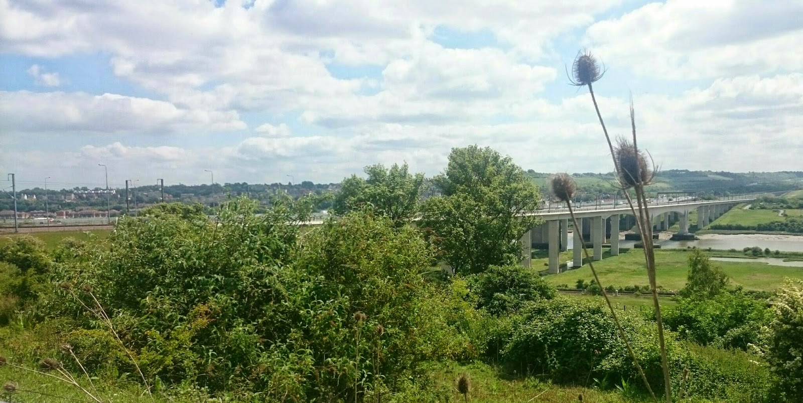
At about midday we crossed the river Medway,  which involved much traffic, many bridges, roundabouts and pavements. Pedestrians and cyclists have their own little section,  thankfully. The tide was out, there was a very long drop and some interesting looking marshes far below. It's about a mile to walk across, not especially attractive but it actually made an interesting change from woods and fields.

We bought lunch at the co-op in Borstal,  dominated in name and location by the young offenders detention centre on the hill above it, and then followed lanes and tracks around the hillside to the south.

It was very warm by now in the open sun, cooler under the shade of the trees. We stopped briefly at Bluebell Hill view point,  from which there are fine views.

An odd little paved path lies down to the by side of a busy road, where there were speckled brown butterflies. We took the underpass and a green lane.  Both Rob and I noticed that the signpost was red, which usually means a byway open to most vehicles - and thought that must have been a mistake as you wouldn't get a car down here.  But no!  Not only can you get a car down here, you can get two! As long as they are going in the same direction.

Towards the end of our (long) day there were some more ups and downs, in order to cross a horrible dual carriageway which runs through the middle of Detling village - which would otherwise be a lovely little place. Thankful for, plus sad because of the necessity of it and reasons for its construction, the fine bridge over the A249.

A few more ups and downs around a very pretty view point at Hare Hill and we arrived in Thurnham.  We are at The Black Horse Inn,  which is much larger than I expected and serves excellent food.

Monday, 25 May 2015

North Downs Way - Day 4

Westerham to Wrotham
Distance: 16 miles
Ascent: 415m
Weather: mostly cloudy
Partridges, blue, tortoiseshell and peacock butterflies, red kite
Low trees successfully navigated: 1
Bumped heads: 1

As we left the hotel in Westerham, the receptionist asked what we had planned for the day. When we said we were walking to Wrotham (Rootham) she asked why. Good question, why indeed. Something to contemplate during the day. She wished us well on our journey and we left (after visiting the Nisa local shop for mediocre sandwiches.)

We walked back up the pavement alongside the busy road to join up with the NDW again. A few cyclists went by and there was a bit of getting off and walking and a bit of dangerous weaving around going on.

The verges were covered in cow parsley, and soon we were too. Plus cuckoo spit. Then followed a discussion about what cuckoo spit is exactly.

The footpath took us through large crop fields including beans, with little copses between. At one lane crossing, the signpost had a waymarker for the E2 footpath - which we could follow to the south of France if we wanted. Although we didn't bring our passports with us.

We passed a big bench with distant views of big house through an archway cut into a big hedge.
We clambered under fallen tree then walked around the edge of parkland to the hillside at Star House. There were a couple of other walkers but most of the people that we saw were runners. Here the path on the map waves around the edge of the fields, on the ground this was quite hilly. Our actual route was more of a sawtooth. We dropped down to a main road,  and having walked along the edge of it, noticed that a footpath joined where the pavement started, a far more convenient place to come out than via the overgrown little path and busy road we'd used, and indeed it was signposted the NDW from this side. We checked the map and the guide book,  which didn't mention a different path. It may have been signed,  but we didn't see anything obvious. Dropping down off the ridge seemed unusual here, I thought it was maybe just because of the location of the bridge over the motorway,  but it seems that there is a government research facility up on the hill. 

We crossed the M25 again, this time with its 40mph signs flashing, and followed the lanes into Otford. In the outskirts of the village they have fields of heather and fields with sleepy goats. Today was the Otford fete and we joined the many people walking into the village for the festivities. Along the way, we passed a post which is part of the village's model of the solar system, which is the largest scale model in the world.  We only found Uranus, which sounds about right. Otford can also boast that it has the only duck pond in the country which is a listed building.

Leaving Otford,  we called in at the railway station to take advantage of the toilets, and headed up the path towards Otford Mound and its tumuli.  Covered in trees. We emerged on to a small cross roads,  and took a wiggly path through the wood rather than road.  We were rewarded with meeting a squirrel.

Just passed here Rob hit his head on a low branch because he was checking the map,  or possibly the cricket score.

There were sheep (first in a few days)  and a floral horse. Before heading back into trees we stopped to watch a red kite that was flying around.

The walk ended through horse paddocks,  with pie, skew possibly painted horses where there were many new, and squeaky kissing gates. I think I may prefer stiles. There was an enormous beech tree, which could be the Faraway Tree.

We are now in the Bull Hotel in Wrotham,  and have been fed very well (Wagyu steak!) and Red Top ales, plus some Smoghouse Smoked Porter.

Sunday, 24 May 2015

North Downs Way - Day 3

Reigate Hill to Westerham
Distance: 16.5 miles
Ascent: 525m
Weather: mostly cloudy,  warm
Jays, squirrels, pied wagtail, lots of sparrows and starlings

Surrey is the garden of England* (or at least the golf course) and our walk this morning started through one designed by Capability Brown. Unfortunately the NDW (as it often seems to) follows the drive between some functional looking buildings and the tennis courts, rather than through the parkland with its sparkling lakes. Golf course update: Reigate Hill course looks very attractive.

We called in for some supplies on the outskirts of Merstham, and then walked down Quality Street! Then we crossed the M25 - which was moving well, don't know what the fuss is about - and then the M23.

The path angles up across fields away from the roads, although the M25 was in view in the distance.
In the meadows there were more common blue butterflies, birdsfoot trefoil,  forget-me-not under mackerel skies. A lane led to a trig point in pretty meadow.

It's not often that you see an aeroplane in someone's front garden, let alone two aeroplanes.
A bit of road walking down the lane took us passed Whitehill Tower and then into Oldpark Wood, carpeted in white ransomes.

We had an early lunch on a bench just before Pilgrims Fort (there are a lot of Pilgrims places along here - Way, House, Cottage,  Lane, Holt, Farm) as there was a bench and the weather forecast for this afternoon was a bit iffy. Then passed somewhere called The Devil's Hole, which we didn't see, but we did see an enormous rabbit hole.

Oxted Down is an old quarry and there were masses of butterflies and an unidentified bird of prey flying low over fields. Here we crossed the meridian line back East again. We stopped for some tea and a biscuit on the other side of the down. Then the path turned steeply up through Titsey Wood, where we heard a woodpecker.Just as we were leaving the woods, we were passed by a couple of walkers, one of whom was barefoot, which doesn't really bear thinking about. They also had short sleeves and crop trousers,  which cannot have been much fun down the overgrown little path. I was stung by stinging nettles enough times through my trousers.

A private road took us between massive houses, their desirability dampened somewhat by all the signs of burglary patrols and flytipping warning signs.

At the end of here we were in Kent, and turned off down to Westerham, a few drops of rain just as we arrived at the Kings Arms.

PS. Yesterday I found a two pound coin on the path. I was going to buy an icecream with it, but have decided instead that I shall take it to Canterbury, as it is customary to carry a token on pilgrimage - typically a shell (we've passed a couple of shell totem posts) and I think a couple of quid will be more use to the roof fund than a seashell.


*as stated by Mrs Elton in Emma by Jane Austin.

Saturday, 23 May 2015

North Downs Way - Day 2

Newlands Corner to Reigate Hill
Distance: 20.5 miles
Ascent: 700m
Weather: warm
Discarded stuff so far: two socks yesterday (not a pair) and one today.

We set off about 9:30 and called at the kiosk at the visitor centre for provisions, including excellent flapjack with fudge, cranberry and seed topping.  Lots of walkers, cyclists and bikers were out. 
Heading eastwards seemed less popular but there were still a fair few speedy mountain bikers on the track - plus a couple of horses at an unfortunately narrow section.

We (or rather I) decided (and Rob came with me) to make the detour to visit Silent Pool, which is 100m down and then back uphill. It was here in 1926 that Agatha Christie's car was found when she mysteriously disappeared for 11 days. On a sunny morning with birds singing and ducks swimming, it was rather different to how it must have been that December day, with eerie silence and an abandoned car.

At Little King's Wood we stopped for elevenses, with plenty of insects for company.

Through Ranmore Common we saw loads of butterflies,  includes common blue, white admirals, brimstones, little yellow /gold coloured moths.

Plus there was a black and white bird flitting about from branch to branch, which we're not sure about.

Along here there are a lot of WW2 pillboxes, and we had a look in one of them. It was dark, damp, littered and rather unpleasant - but possibly no more or less so than it would have been when in use.

To cross the A24 there was a bit of a detour up to Burford Bridge subway, and then back down.  We called in at the toilets, which was necessary but definitely a 2/10 rating.

After navigating the stepping-stones, for what there was a bit of a queue, we climbed Box Hill. We definitely weren't the quickest,  but at least we didn't get lapped.

At the monument we stopped with the crowds for lunch,  then continued onwards, barely seeing anyone from then on but a few groups of DofE'ers (leaving a trail of tent pegs) and a rather wobbly mountain biker. This was quite surprising, as the path was very pretty with holly, flowering hawthorns and ransomes. Most people seemed to be far more interested in the car park and the burger van.

We stopped to have a chat with one group of kids (not the mean girls taking selfies) and confirmed that they were indeed just where they thought they were, unusual that they spoke to us - people do not seem to say hello round here.

There were a lot a ups and downs for the next section of the day, up to Colley Hill, where there is a little monument pavilion place (and a watch tower that you can't photograph because it's in the trees) and fine views. What the guide book doesn't mention is the noise from the M25 which runs about 100 yards north of here.

Just a little further on we visited Reigate Fort, on Reigate Hill, which is very modern for a hill fort.  It was built in 1890 when there was troubles with the French,  and used again during the world wars, and then by the scouts.

The Bridge Hotel is just around the corner and much larger than I expected it to be.  The walk to the bedroom is quite an addition to today's mileage. 


Friday, 22 May 2015

North Downs Way - Day 1

Farnham to Newlands Corner
Distance: 14.5 miles
Ascent: 400m
Weather: overcast, humid

The relocated footpath did indeed take us back to the NDW path this morning - right through the middle of a landfill site, which wasn't particularly attractive - but it was better than the busy road and we saw a cinnabar moth.

We walked through Runfold Woods again , and the information board with the You Are Here arrow in the wrong place annoyed Rob again.

The path went alongside some potato fields, then along the top of Puttenham Common and then emerged into Puttenham.  Here we reassessed our definition of the phrase 'that's a big house'.

At the golf course, we passed a group of chaps teeing off, with varying degrees of success judging by the raucous laughter and swearing. I can't judge them on their standards of golf, but can (and do) judge them for using buggies. As the track passed the 10th tee we met a group of much, much older chaps who seemed much happier, were friendly and enjoying their five mile walk around the course.

There is also a rare breeds farm here, with pigs and interesting horned English Goats.

We called in at the cafe at the Watts Gallery for tea and massive scones with jam and cream.

The route passes through Shalford Park nature reserve, where at least they are honest about the nature that you will see there, the information board telling of such things as robins, chaffinch, moorhens and jackdaws. We did see these!

The route of the NDW here, and in many places along its length, is also the,same route Pilgrims' Way. The Pilgrims' Way isn't as old as its italics on the map might make one think - certainly pilgrims did walk from Winchester to Canterbury but their actual route is not known and it's likely that the well used ways simply became lanes, then busy roads, then the A31.

A very sandy bridleway (with reluctant looking horse being made to carry large person up a hill) led up to St Martha's Hill. We had a sit on one of the many benches and admired the view. To the south you can see Chanctonbury Ring on the horizon - and we remembered that on the day that we walked along there, we were looking over to the North Downs in the distance.

Around Albury Downs there are lots of benches and views over the valley and steam train. We had a brief stop at the visitor centre and then headed north up to the The Manor House Hotel where they have the Hogs Back TEA.

Thursday, 21 May 2015

St Swithuns Way - Day 2 and North Downs Way Day 0

Alton to Farnham
Distance: 16 miles
Ascent: 180m
Weather: warm and sunny
Buzzards, deer, red kite, long-tailed tit, french partridge,  bunnies, horses that can't spell (or win), Austin Healeys 

As we left Alton this morning, a lady pulled up in her car to ask us something about the ramblers, not sure what as a truck went past, possibly were we looking for them, did we want to join them, or did we know where she could find them... It seems they are an illusive lot. We just said no.

Today's walk could potentially have been quite boring,  as it follows the side of the A31 road, but as it happened it was very pleasant and although we were in earshot of the road it was not intrusive and we rarely saw it.

We had a sit on Walter's bench, with views across the fields - buzzards were circling overhead and there was a small herd of deer. It was very peaceful.

A short distance on, we walked by a reservoir (or, more accurately, pond) and were passed by a horde of noisy ramblers, one of whom joked we were going the wrong way. Nope.

The path was mostly along and through fields,  with some woodland and a few bits along lanes through pretty villages.

In Upper Froyle we saw gnarly trees in the church yard, Hampshire sheep and very pretty thatched cottages. A wooded drive led towards the grounds of Pax Hill which  was once the home of Lord Baden-Powell,  now a nursing home.

The day was warm and still, and the butterflies were out in force - we'd not seen many earlier in the week.

At Farnham we stopped at the castle (worth the entrance donation to use the loos) and had a look at the keep and battlements,  and had a picnic.

St Swithun's Way ends in Farnham, which is a pretty little town with terrible traffic.

The North Downs Way begins near to the train station,  on a horrible junction with many pedestrian crossing buttons and many pedestrians taking their lives in their hands.

Thankfully we soon left the side of the dual carriageway, and walked down a leafy track where there is a commemorative bench for the start of the Way (not sure what was carved into it, possibly a thistle,  possibly something else) and up into a pretty nature reserve at Furze Hill. Here the footpath that we'd meant to take down to our accommodation stop had been moved, due to a landfill site, so we took the next one and had to walk down a very busy little road that was rather worrying for a couple hundred yards but from the t junction there was a pavement. Opposite the pub there is the end of the footpath that we would have taken,  and Rob had a bit of an investigate.  We shall attempt it in the morning to avoid the road.

We are staying at The Princess Royal, a Fuller's pub - they have Sky Sports so we were able to watch the end of the test match.