Distance: 20 miles
Total distance: 202 miles
Ascent: 120m
Weather: warm and sunny
Views: Skiddaw, big aerials
Reed bunting, grey heron, hare, deer
In wet conditions, I would strongly recommend staying on the roads for this journey.
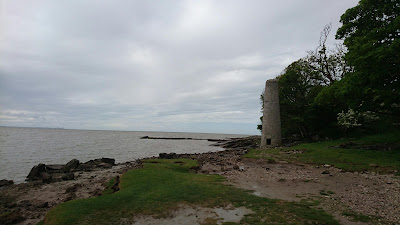
We left Silloth, via the co-op for supplies, passing the North Cote lighthouse, which used to be one of two lighthouses here that moved along on a track, because of the shifting sand channels.
At Skinburness, we decided to use the footpath that crosses the saltmarsh rather than walk around the road. The grass was dry and the channels dried mud, mostly easily managed. The path on the ground vs the path on map are quite different, the sign posted path was fine, despite the first footbridge being broken, up until the point, about half way, when we reached a creek which had been made recently dug out, leaving a steep banked channel with deep muddy water that was too wide to jump. We walked up and down the meandering trench a fair ways and attempted a crossing at one point, but the mud failed the foot integrity test.
The path on the map led to a little stone bridge, obstructed by a barbed wire fence with no stile, but given there was no other option, we climbed over.
The sign posted path was a long way out from the mapped route, heading out around a rough gorse patch. We followed this hoping there'd be no more obstacles. We headed towards what we thought was a post but it turned out to be an old fence post, actually right on the paper map route. We followed that for a while, through reedy, cow-y, grass with some bridges following a field boundary with gorse. We approached a herd of cows, who entertained us with a display of jumping - some more successful than others. Leaving the saltmarsh at Rabycote Marsh, we followed the path along to Winding Banks, shallow and still today, but the banks along some of the river, and half of Rumbling Bridge, had been washed away during the winter.
For a few hours after this we were road walking and it was hot, with a wide blue sky with little fluffy clouds. We stopped for lunch in field gateway, with buzzards circling directly overhead.
Beyond Newton Arlosh we turned up to an overgrown footpath to skirt around some fields into Kirkbride. Unexpectedly, the footpath goes through Monks Dyke woods and reedbeds rather than along the dismantled railway line. We passed a couple of massive aircraft hangars, with orchids in front.
Ice-creams were had in Kirkbride, and we headed north through Angerton and out into the South Solway Mosses National Nature Reserve. The information board showed the access points into the open access land, while warning to beware of bog, adders and ticks. Out in the reserve we saw a deer and low flying curlew. Even though the ground was dry, it was still very spongy underfoot.
Emerging into farmlands, we crossed some fields being harvested for haylage with a forage harvester and relay team of tractors pulling trailers.
We are now at dinner at the King's Arms in Bowness on Solway, and have discovered there's nothing quite as funny as Dutch people repeatedly trying to say the word rhubarb.


