Sunday, 26 August 2012

Ennerdale in the Rain

Distance: 10 miles
Ascent: 250m - today we climbed about 90 floors, 10% of which were in the hotel.
Weather: rain, rain, rain
Seen: a jay, a deer, water
Plans: abandoned
Today we were going to climb Pillar from Ennerdale. We headed off early with a hearty breakfast inside and the promise of a fine day. We parked up in the car park down in Ennerdale valley and set off at about 10am. At about 10:05 am it started raining, and didn't stop for the next three hours. We are used to rain, but this was pretty serious rain.
The forest tracks were overflowing and High Beck, which, according to the fell guide book, we should "gingerly ford" was a raging torrent of water down the hillside.
We stopped under the non-existent shelter of some pine trees and took stock, deciding to abort our high level walk in favour of a walk around the valley. Ennerdale is beautiful, even in the wet.
About 3/4 of the way around, it stopped raining but the tops were always in cloud. We saw a deer and then, when the sun had come out a bit, we saw a lot of people. Most of them were dry.
We are going to attempt Pillar again next weekend, this time from from Honister, and Rob has declared we are going to the top, whatever the weather.

Friday, 24 August 2012

Around Great Gable

Distance: 13 miles
Ascent: about 1300m
Weather: Cloudy, a few showers, a few sunny moments, quite warm
Wainwrights: six down, six to go
Anxious moments: a couple

Today's walk took longer than might be expected, given that it wasn't particularly long or particularly high - however it was pretty blumming steep going up in places and quite alarmingly steep coming down in others.

We parked at the NT car park behind the YHA at Honister, and crossed the mine yard to the gate leading up to Grey Knott. It didn't seem to take long to reach the summit, helped by the fact the car park sits at 330m. There are a few tops, so we visited some of them, before heading off over the plateau top to Brandreth, congratulating ourselves on having a day out on the Fells rather than being at work.

From Brandreth, we headed part of the way up Green Gable, then veered off down to Base Brown and back up, where we seemed to meet up with some crowds for a while. I didn't really notice the summit of Green Gable, as it is completely overshadowed by the looming mass of Great Gable behind, and there were a few people sitting on it. A short scree slope heads down to Windy Gap (where it didn't seem overly windy) and then up the rocky slopes of Great Gable. A fun scramble brings you up near the top and we stopped to have some lunch sitting on a rock in the sunshine with views of Crummock Water.

The descent of Great Gable is probably best glossed over, especially if you turn off the path too soon and end up on a scree slope of steepness and screeness that was a times ok and at time horrendous. I know scree running is a thing, but it's definitely not my thing. We had a sit on a rock at the bottom, some time later, and washed the dirt off my hands and had some more lunch.

After we'd calmed down a bit, we set off up Kirk Fell. Kirk Fell sits quite low and squat with very steep sides, and a rocky path heads up and then across the fell top, complete with the very creatively named Kirk Fell Tarn.
From the summit cairn, we followed the line of the fence posts down to the rocky paths that heads down. I had a slight wibble at the first step down off the edge, as it was quite a big step, plus I think I'd been more unnerved by the last descent than I'd thought, but we made our way down slowly and carefully and it was fine.

The return path was narrow and rocky to begin, but got wider and easier as we went along. It skirts back around under Kirk Fell back to near where we came down off Great Gable where we got to walk up a bit more scree (that was fine) and then the path contours round under the mounds of Great Gable and Green Gable.

The easy path took us over the grassy hillsides back to the Honister mine, where a well maintained path leads back down to the car park.

I had to sit on my coat in the car because the seat of my trousers was so dusty.


Sunday, 12 August 2012

Caldbeck Fells

Distance: 13 miles
Ascent: 1000m
Weather: Sunny, a little breezy on the tops
Summits: Carrock Fell, High Pike, Knott, Great Calva
Brown feet: 2 a few hours apart, both Rob's

We filled up with a lovely big breakfast at The Mill Inn in Mungrisedale and, after putting on some sun cream and watching Ed McKeever winning gold in the kayaking, set off for today's walk around the Caldbeck Fells.

It was warm and sunny, and has been fairly dry lately so we set off in trail shoes rather than waterproof boots, our feet did get wet during the day, but they stayed cool and dried out fairly quickly after any dunking. Rob's feet, however, are now an interesting shade of brown.

We parked up by the side of the lane under Carrock Fell (649m) and took a path up the fellside that was quite steep and hard going in places, I'm quite glad we chose to go up that route rather than down at the end of the day. But it soon levels out and becomes much easier (apart from a boggy hole that snuck up on Rob's foot)  towards Carrock Fell, where there is an Iron Age fort, and some more modern looking sheep folds and shelters. The path leads straight to Hare Stones on the Cumbria Way path, and we took a turn to go up High Pike (658m) and then back to the track. After a short way, there was a sheep trod heading off right in a fairly straight line to Great Lingy Hill from where indistinct paths lead all over the place, through the heather and occasionally boggy ground. We made our way through the rough around Little Lingy Hill and up the hillside to Knott (710m) managing to keep our feet relatively dry.

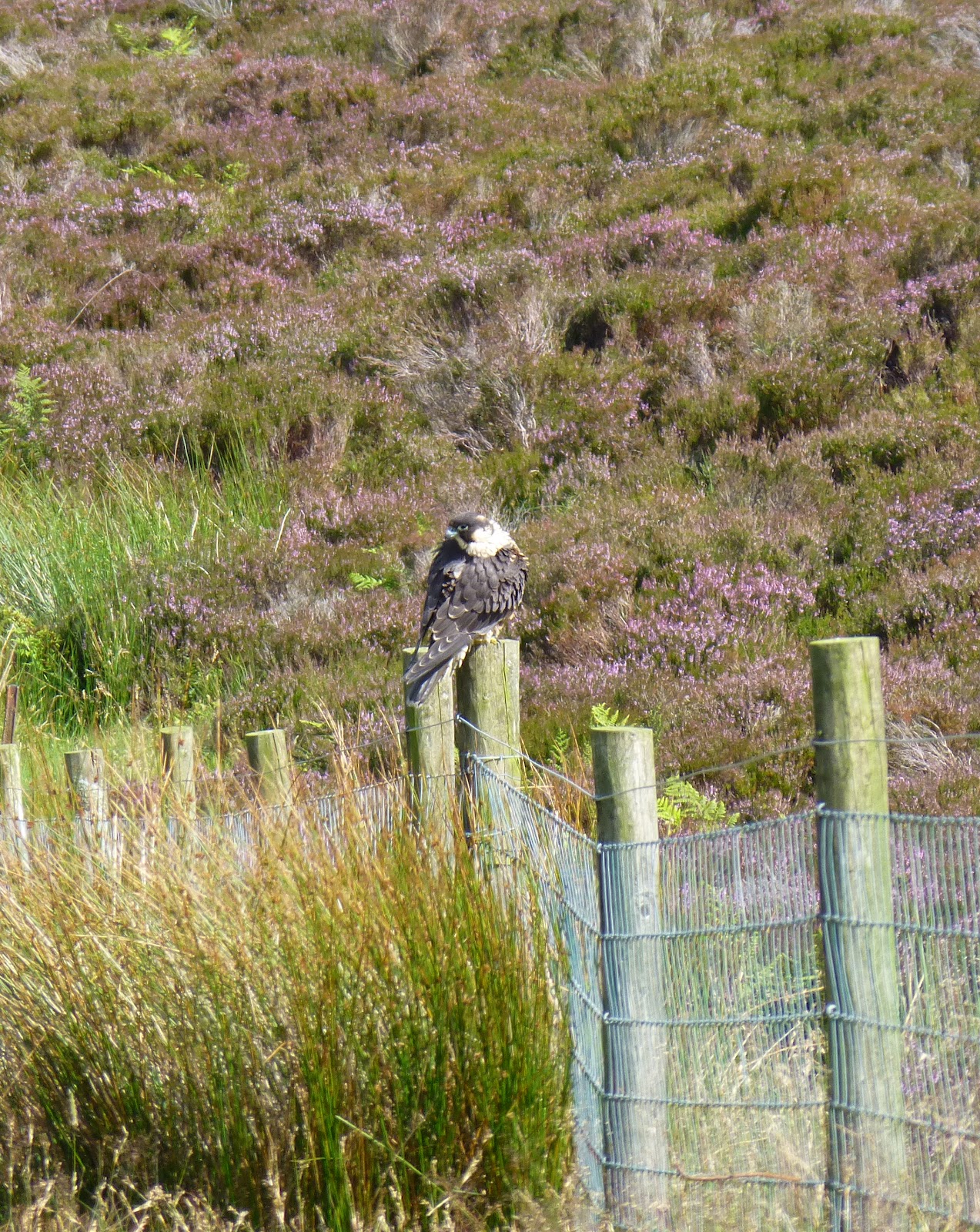
We had a lunch stop (including bad cheese / dairy product jokes) in the sunshine on Great Calva (690m) and then followed the path down to meet the Cumbria Way path where it crosses Wiley Gill. Here Rob found another boggy puddle and we had a good view of a peregrine falcon having a sit on a fence.

The easy track leads back into Mosedale along the river and then we followed the lane to our starting point.


Wainwrights ticked off today: 3
Remaining: 12

Sunday, 29 July 2012

Beddgelert

Distance: 5 miles
Weather: cloudy with rain showers, som
Campers: happy

This week has been a Grand Family Camping Holiday in North Wales, and we joined them for the weekend - our "big tent" looking very petite compared to our neighbours' tents on site. This was the last time we used our Robens Granite.

On Saturday afternoon, after a spot of shopping and pizza for lunch, we went for a family walk around Beddgelert. Due to the weather (wet) it was at first decided we would just have a walk down to see Gelert's Grave, but then it cleared a little so we carried on. We waited by the railway to see a steam train on the Welsh Highland Railway pass and then made our way along the Afon Glaslyn. The riverside path south of Beddgelert is rocky and in some places quite exposed over the fast flowing water and close to the rapids below. My young nephew, in his new walking boots, thought this bit was awesome. I would concur.

At Pont Aberglaslyn we turned away from the river, under a railway bridge and up over Cwm Bychan. The track was a little boggy in places, my feet (in my Asics) got a little wet crossing a boggy patch and my nephew's feet and his new walking boots, got very wet and muddy indeed when he "tripped" and ended up knee deep in a boggy puddle.

At the top of the ridge, we made our way down a quite steep slope passed the Sygun Copper Mine and down to the lane. Back along the lane into the village, to round a lovely afternoon off with an ice cream at Glaslyn Ices.


Sunday, 15 July 2012

Sale Fell and Ling Fell, Great and Little Mell Fells

Distance: 7.5 miles
Ascent: 850m
Weather: bright and breezy
Wainwrights ticked off today: 4
Wainwrights remaining: 15

With a good weather forecast for today, we decided to tick a couple more Wainwrights off our list. So after hearty breakfast (at which some of the other residents seemed a little more subdued than they had been making their way to bed after midnight last night - the walls of the inn here are remarkably thin) we headed off to Sale Fell and Ling Fell in the north-western fells.

We parked up a little lane near to Brunston Bridge and headed through a gate towards Kelswick Farm, where we zig-zagged (with superfluous zag) up the hillside. The green grassy path was pretty with harebells and tiny purple and white flowers, lots of buttercups and yellow tormantil. Quite suddenly we were at the top of Sale Fell (359m) where it was quite breezy, and headed along over to Dodd Crag and a knee-jarringly steep descent back to the lane.

We then headed over Brunston Bridge and up Ling Fell (373m); it was very warm on the sheltered side as we went up and less warm in the wind on the top. It was a clear day, and we had good views of the surrounding higher Fells. We returned down via the grassy Corpse Road, where there actually was a corpse, but thankfully just a vole.

The day was still fine and it was only early afternoon, so we decided to do the Mell Fells on the way home. Great Mell Fell (537m) is an unusual fell, with a lot of windswept trees on it (possibly larch) and long lush grassy meadow as there are no sheep up here. We then drove the short distance around to the other side of Little Mell Fell, parked up by the side of the road and took a short sharp path up to the top (505m). According to the route, there should be a less steep path contouring around more to come down by, but we either missed it or it isn't there on the ground, so after a bit of wandering around on the steep grassy slopes, lots of sheep here, we found the direct path again and followed that down.


Ling Fell from Sale Fell


Sale Fell from Ling Fell

On Great Mell Fell

Saturday, 14 July 2012

Troutbeck Tongue and Gray Crag

Distance: 12.5 miles
Ascent: 1050m
Weather: overcast start, bit of rain, sunny later
Things of interest: lizard, two different types of orchids, bogs.
Minor route amendments: many
Wainwrights: 2

We drove up last night and stayed at the Kirkstone Pass Inn, where this morning they filled us up with a fine breakfast and by 10am we were off up on to the Fells.

To avoid half an hour of walking along the Kirkstone Pass road, we headed up the hill behind the pub to St Ravens Edge and then picked a path that headed down Woundale, through some exciting bogs and lizard territory. We rolled our trouser legs up a couple of times, but although large, the puddles weren't particular deep.

The track comes out onto the road, which we followed for a short time and then took a gate near a sheep fold and headed down to Wounded Beck where there are lots of walls and a small wood. After negotiating the walls and the very wet hillside, we crossed the beck at the footbridge and then couldn't find the path that we had seen quite clearly when we'd been higher up. To avoid more wandering around in boggy, brackeny ground, we followed the good path down and around the farm at the bottom of the Tongue, and then followed the track that leads up above Hagg Gill.

From here. the path up to Troutbeck Tongue isn't clear to start with but becomes a good path once the muddy slopes at the bottom have been cleared. Once up on Troutbeck Tongue (363m) it started to rain a little, and as usual we decided to put our waterproofs on just as it was about to ease off.

First lunch was had just north of the Tongue, under the watchful gaze of some sheep, who I thought were after my baguette, but they were just keeping an eye on us, and then we headed up the track near Blue Gill to emerge just north of Froswick, and walked up to Thornthwaite Crag (784m), in clouds. The path was clear towards Gray Crag (697m), and we headed there and back quite quickly. To avoid the steep rocky path back down from Thornthwaite, we followed the wall and contoured around and down to Threshthwaite Mouth (near to where we sat and dried out after our High Street walk in August 2005) and had our second lunch on a handy rock. As we left our rock, it was quickly appropriated by a couple (with no sit mats!) who declared it a lovely spot for tea and biscuits. Shame we hadn't had any tea or biscuits. The exact location of our biscuits at that time isn't something I'm prepared to comment on.

A quick scramble up to Stoney Cove Pike and we were on the tops over Caudale Moor (754m) where we crossed over the drystone wall a few times to avoid some bogs, and then back again over St Raven's Crag to the Inn, where we are now having dinner and a few pints of Tirrill's Old Faithful.


The Kirkstone Pass Inn in the evening - we didn't see the ghost.


Stone bridge over Wounded Beck.

View from Caudale Moor towards Windermere.

Saturday, 7 July 2012

Seathwaite Fell and Lingmell, via Broad Crag

Distance: 12 miles
Ascent: 1050m
Weather: bright and sunny, little cloudier on the tops
Hordes: many
Mountain marathon runners: many
Weasels: 2
Wainwrights ticked off: 2
Remaining: 21

The day after one of the wettest days in one of the wettest summers on record, we decided to go for a walk in one of the wettest places in the country. Borrowdale averages 120 inches of rain a year, compared to 50 inches in Keswick, just a few miles away.

It was warm and dry as we set off from Seathwaite at about 9:30am, where plenty of cars were already parked up by the side of the road. Our path lead up towards Styhead Tarn, but we turned off right just before the footbridge and made our way up the hillside to Seathwaite Fell, where we visited the two peaks and a bog.

We skirted around the wet, rocky edge down to Sprinkling Tarn, where there were loads of little fish, along to Esk Hause and up underneath Great End. There were A LOT of people having their lunch here. We went over a boulder field near Ill Crag and then over Broad Crag (this seems to be popular route for people doing the Three Peaks Challange, which may explain, if not excuse, the presence of a couple of smurfs and Captain Jack Sparrow) which is a boulder field and then down a very steep, scree-y path at Broadcrag Coll to then head up again to Lingmell. We had Lingmell to ourselves, with clear views of the train of people heading up and down Scafell Pike.

Coming down to Lingmell Coll we started looking for somewhere to sit and have second lunch, but the wind was quite strong all the way around to Styhead Tarn. We kept on down until just after the footbridge and stopped for a while by the stream and then headed down, admiring the water falls and views into Borrowdale. As we approached the farm in Seathwaite, a couple of girls asked us if we'd seen a big group of people who would have been coming down from Scafell Pike - why yes, yes we have.

Photo gallery from the walk here