Monday, 26 May 2014

Pennine Way Day Five - Haworth to Malham

Distance: 23.5 miles
Ascent: 975m
Weather: warm and sunny
Things on Sheep: one bucket, two birds hitching a ride
Swimming cows: 1
Sit downs: just the one very short one
Cow pat / rock dualities: one (ew)
Feet: hot and a bit dirty (ew)
Herons, bunnies, peacock, little lambs, bullfinch, field fares, dive bombing lapwings, fly-by squawking curlews, gulls, oyster catchers, little goats, herded some geese, got herded along with some sheep.

Had a comfortable night's sleep at The Old Silent Inn, untroubled by ghosts. In the morning, we noticed a certificate on the wall which said the place is officially haunted, according to that The Paranormal Association of Britain or some such.

We were later than planned setting off, due to breakfast being late. Our very convivial host was no where to be seen anyway, and we were not convinced that his being busy with the farm was entirely the reason.
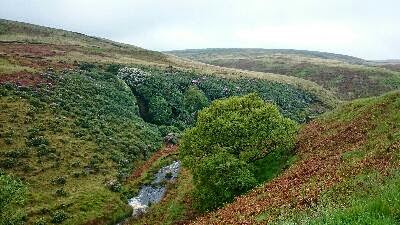
Ickornshaw Moor was boggy, but really pretty. The wonders of sunshine. Although you'd expect somewhere called The Sea to be a bit wet...

Walked through Ickornshaw village, where many of the stone house seemed to have fallen down and the people taken up residence in huts. The residents also seemed to be mostly geese, chickens and goats.

The country turned from south Pennine moorland to hilly farmland of the dales. More cow fields and country lanes. We had a brief sit on a bench and had some lunch, and met a couple of Dutch walkers having a sit down right in front of a gate who are also doing the Pennine Way, although they are doing it properly and camping. Poor buggers. Just after we left them, we went through a small muddy field with some cows, the cows were a bit frisky and seemed nervous about which way to go. Some went up the hillside to go crashing through the trees at the top of the field, but one seemed a bit indecisive and hung around at the back of the group, until it panicked and rushed off through the reeds, and then had to practically swim to get out. There was a bit of mooing and much splashing, it made it out ok, thankfully.

We went a short distance along the Leeds and Liverpool canal,  stopping to pay a small fortune for ice creams and some more water.

The last part of the day,  about 7 miles after Gargrave was along a pretty riverbank. We saw lots of curlews and ducks. The landscape becomes noticeably rockier and then we were into Malham. They are having a strange safari event at the moment,  including a huge model of giraffes in horse drawn carts.

We are staying at The Buck Inn, which has good beer and fine Yorkshire puddings.

Sunday, 25 May 2014

Pennine Way Day Four - Hebden Bridge to Haworth

Distance: 13 miles
Ascent: 600m
Weather: dry and sunny start and finish, but mostly wet.

So today we were out on the wild and windy moors, but thankfully there was no rolling or falling in green. And no Kate Bush impressions either, as there was to be none of that, apparently.

Getting down to Hebden Bridge and back along the canal (saw a Muscovy Duck) seemed a lot easier this morning with gravity on our side.

We then crossed the road and headed up the other side of the valley, up a very steep little cobbled path. There are paths in all directions here and we had to make a choice between the official route and the Wainwright route. We went with the official. A muddy, overgrown little path takes you by an odd water spout thing, then to a tree lined lane and then up on to farm land and fields.

The path crosses a pretty dell with bluebells signposted Hebble Hole (although that doesn't seem to be marked on the map) with a stone footbridge that looks very old and worn indeed, and is even a listed building.

Out on the tops there were lots of curlews and lapwings chirping, especially when we stopped for lunch on a wall, watching the black clouds and impending rain approach over the hills. A hasty pack up was called for and we walked in the rain for a long time after.

The Way goes down a wide tarmac lane with signs forbidding mountain biking, around a couple of reservoirs, one of which was nearly completely empty despite the weather, then up Dean Stones Edge over the rolling moorland (between Round Hill and Dick Delf Hill) to Top Withins. There were quite a few visitors to the ruins out in the rain.

The sun came out as we approached Ponden Reservoir, where we turned off down a lane to get to The Old Silent Inn.

Saturday, 24 May 2014

Pennine Way Day Three - Standedge to Hebden Bridge

Distance: 18 miles
Ascent: 600m
Weather: misty, then rain, wind and rain, blue sky and sunshine (a bit)

It was misty but dry as we started this morning,  over the A62 and over Standedge Edge. There was a family with a couple of very energetic little boys running around arms flapping. Dad had a huge flask.

A hat change was called for, it was pretty windy. The rain started as we got to the trig point on White Hill and continued to get heavier during the day. The paths near here are very familiar to us and we'd thought that it would be strange to do a long distance path so close to home. Mostly it was just wet. The renovation of the path up to Blackstone Edge has been done and it is now very different, seems like a completely different footpath.

We passed the Aigen Stone and walked down the little path across the heather (which is the Pennine Way but most people seem to go the other way down the Roman Road) down to the White House Inn (coming upon a horde of walkers who seemed to emerge from a hole in the ground) and took shelter from the weather inside with a big pot of tea and some lunch.

After lunch, the rain was noticeably harder and the wind noticeably stronger. It was fairly unpleasant walking passed the reservoirs on the straight track. The track becomes smaller and then crosses the boggy ground as a stone flagged path, which gurgled and tipped occasionally.

The guide book mentions Stoodley Pike being visible but never seeming to get any closer, we didn't really have that problem today, as the mist was so low we couldn't see it until we were quite close. The rain stopped and the clouds began to clear, and a stone seat conveniently appeared so we stopped for a sit down and some tea and biscuits.

We didn't go up Stoodley Pike as it was pitch dark inside and not straight, according to Rob. It has already fallen down once before so you can't be too careful (although that was in 1850-something.)

The skies were clearing as we came down off the moors, and it was much warmer. We are staying in Hebden Bridge,  so left the Pennine Way and walked along the canal to town. There were lots of ducklings and goslings and we got hissed at quite a lot.

Hebden Bridge is very, very hilly. We chose to stay at the Hare and Hounds in one of the villages just (just!) up out of town.

Ed. I can't believe that I forgot to mention this, but the weirdest thing we saw today (and possibly ever) was a group of chaps coming down off the moors as we left the White House Inn wearing not much but white robes (possibly bedsheets) in a torrential rain storm. Not sure if it was for a religious thing or for a bet....

Friday, 23 May 2014

Pennine Way Day Two - Padfield to Standedge

Distance: 17 miles
Ascent: 950m
Weather: wet, wet, less wet, wet
Bogs, rivers, ponds, rain, mist
Buzzards, red kites, baby pheasants.
Forgotten keys: 1
Detours: 1

As we set off this morning, there was blue sky and a very bright rainbow, unfortunately just not in the direction that we were going in. The skies over the hills were very dark and wet looking indeed. We retraced our steps back to the end of the Trans Pennine Trail and, taking a brief look down a slippy tunnel, went a bit further and over the reservoir. There was a nice little wood to act as a wind break, but at Crowden we turned up the valley into the wind and rain. There were some birds of prey,  definitely some of them were buzzards, some might have been red kites. As we headed up the valley side towards Laddow Rocks,  we met a runner coming the other way who commented that there were a couple of gnarly river crossings ahead. He wasn't wrong. 

Everything was in spate. The paths were streams,  the streams were rivers and the fords were indistinguishable from them. We managed to avoid the gnarliest of the river crossings by heading up the hillside,  and took a few detours upstream to find crossing places over others, the one near North Grain took a while,  with much wandering through wet grassy bogginess. But we made it over the stream (me by flinging myself head first into the reeds on the other side) and back to the stone flagged path,  which was much appreciated even if it was running with water. 

Coming down off Black Hill we saw a sign cautioning about the difficult ford crossing at Dean Clough so decided it would be wise to take note. The detour added an extra mile, through wet grass, fords and more bog (Rob was lucky to escape with his shoe from one - we decided that the crossing at Dean Clough must have been very difficult indeed, possibly even guarded by bears) on to the Intake road and returned via the Kirklees Way, having to climb over a chained up gate which was odd.

No sign of the burger van as we crossed the Isle of Skye road,  then headed down to Wessenden Reservoir,  startling a pheasant with some babies. It was dry-ish but misty along here.

As we dropped down and back up the steep clough, the heavens opened, but soon it was blue sky and sunshine, and lots of birds singing. It rained again as we got near the reservoir and the A62, but as we went in the pub it stopped. We are staying at The Carriage House, which is very comfortable and does lovely Turkish food.

Thursday, 22 May 2014

Pennine Way Day One - Edale to Padfield

Distance: 17 miles
Ascent: 800m
Weather: rain first thing, then cloudy, cool
Mountain hares: lots
Red grouse, golden plovers, Buzzard (Rob saw this, I was watching where I was putting my feet at the time),  bunny, four bees.
As we left Edale in the rain, we heard a murder of crows and then saw a dead blackbird. Hopefully these are not portentous.
The path led through sheep fields with lots of lambs and along the valley from Upper Booth and then up Jacob's Ladder. This was quite steep but not bad. Over Kinder Low and Kinder Downfall we saw no one (but a startled rabbit) and were starting to think this was a bit strange,  when we came upon various hordes.
The rain stopped but it was still quite chill, gloves were put on and taken off a lot.
We stopped for lunch in a sheltered spot and the sun came out briefly. Very glad that we'd brought the flask.
The stone flagged path was quite easy going, but the rocky paths are quite hard work. Bleaklow wasn't bleak at all but very green where it has been reseeded,  and there were lots of birds and hares. Most of them were alive.
The path to Crowden went up a steep sided valley with more up than I expected,  and then down a very steep little path to the Trans Pennine Trail where we turned off down to Padfield (being chased by dark clouds and impending rain) to the Peels Arms.

Saturday, 17 May 2014

Last Training Walk

Distance: 11.5 miles
Ascent: 550m
Weather: warm and sunny
New wind turbines: 2
Ducklings in peril: 1

With just a few days now until we set out on The Pennine Way, we decided to make today a reasonable distance but not too long - our history of pre-walk injuries supports this. So we headed out late morning for a walk through over Bishop's Park, to Delph and Castleshaw, passed the The Royal Oak pub (shut Saturday afternoons) and home.

Sunday, 11 May 2014

Rishworth Moor Weekender

Friday evening
Distance: 4 miles
There has been a noticeable hiatus in training for the walk due to me sustaining a vascular injury in my foot a couple of weeks ago. Thankfully, my lumpyfootitis superficial thrombophlebitis has improved and I was confident that I would be able to walk on it this weekend for some much needed exercise in preparation for the Pennine Way.

So with foot well padded up, we set off on Friday night for the exotic Newhey Premier Inn. We started along the track. which has had some hardcore laid down so isn't the mudfest that it has been lately and then over Brushes Clough, cutting through horse field down to cross the stream and head up to the farm through a bluebell filled field.

We avoided the main roads by going up the cobbled street to St Thomas' church and then around the back of the memorial gardens to the hotel.

Saturday
Distance: 12 miles
Weather: heavy showers, occasional sunshine
Jay, mistle thrush, little lambs, three deer, a heron, orange tipped butterfly, bluebells, bog and an angry dog.

We set off about 10am, calling in at the shop for some sandwiches. As we came out the rain started, so we put on our waterproofs - and kept them on for the rest of the day, although the sun did come out occasionally. We walked up a wet path, where Rob practiced his dog control skills on a rather agitated farm dog that had snapped its chain, to the Pennine Bridleway

We followed the bridleway under the motorway and around Hollingworth Lake (where we had a sit down to rest my foot) and then joined the Rochdale Way along Whittaker Lane. We surprised a heron, who in turn surprised three deer. A good oppotunity to test out the 30x zoom on my new camera.

It started raining hard as we got to the Roman Road and we splashed our way along the Old Packhorse Road (stopped for lunch near the ford at Rag Sapling Clough when the sun came out for a while) and around Green Withins Edge over Rishworth Moor to the Turnpike Inn. Still not able to identify the mysterious birds in the woods near Rishworth Lodge.

Sunday
Distance: 12 miles
Weather: Sunshine and showers

Very leisurely breakfast and late start this morning. We went back the way we'd come yesterday, this time taking the lower path at Joiner Stones Hill down to Green Withins Moss and the reservoir. It was very windy in patches around here and quite chilly.

We followed a big path (cough Pennine Way cough) over Windy Hill bridge to the aerial and down the churned up messiness of Windy Hills to Piethorne Reservoir. We didn't stop for lunch, as it was raining and there was some football to be watched, so we struck on for home via Top O'Th'Hill and Brushes Clough.